Joyce Kilmer - Slickrock Wilderness
March 12 - 13 2016
2016 bag nights: 1
My previous
two visits to the area had ended in failure, but third time's the charm, right? :)
The weather report did not look good, but when you have permission to abandon your family for 3 nights to go visit the woods ...
I met JC at Beech Gap for what was planned to be an easy 3 nights, covering about 25 miles.The weather report called for a high chance rain most days and there was a threat of thunderstorms one of the days, but it wasn't looking like it would be too much rain. We hoped for lots of grey and a minimum amount of water (The NWS had forecast .1 - .25 inches overnight), didn't turn out that way.
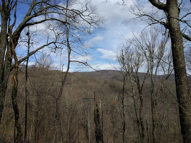
The view from the old forest road gave us hope regarding the weather.
Looking north into the Slickrock watershed.
We had an easy hike up and over Stratton Bald ...
... and on to Naked Ground where we set up camp, gathered water and had dinner. The wind was blowing a pretty constant 20ish MPH and the sky was overcast, but the view was still nice. There was a hint of the moon and even some stars at one point, that left us hopeful that maybe the weather was going to cooperate.
Awesome view looking down the Little Santeetlah Creek watershed towards the Joyce Kilmer Memorial Forest. You can just make out Lake Santeetlah in the distance.
Heard some rain in the middle of the night, but rolled over and went back to sleep. Woke up around 5:30 with lots of wind-driven rain against the tarp and somewhat of a cold butt. That was surprising since I had a 20 degree underquilt and it was above 40. I discovered that I had water running down my hammock lines and it was pooling under me. There was not a lot, but it was enough. I realized that I would not be going back to sleep and so I got my phone and read for a bit and listened to the wind and rain. After a while, I noticed an occasional drip on my face. At first I thought that it was humidity getting bounced off the inside of the tarp, but I realized that I had hung my new tarp wrong and the seam was channeling water under the tarp. It was about this point that I realized that this trip might be cut short.
The rain finally slowed down around 9 and I crawled out of my hammock to find JC and retrieve the food bag. We talked a bit about bailing and when he checked his phone for the weather, it was saying 80% chance of rain all night and the whole next day with possible thunderstorms. As we were talking, the rain kicked up again and we decided it was a sign. While we were packing up, I noticed that JC had left his cup out against a log. It had almost 2 inches of water in it and my pot that had a lid on it (just a tiny hole) had accumulated about a 1/2 inch.
Same "view" as the evening before, the Memorial Forest is down there somewhere.
We decided to leave our packs at Naked Ground and have an easy hike over to the Hangover. It was basically like hiking in a cloud, but the rain had mostly stopped.
Not much to see from the Hangover. This is looking south towards Jenkins Meadow.
By the time we got back to Naked Ground, it looked like the clouds were trying to lift. We decided this was a good place for lunch before heading back to the trailhead.
Once the rain finally stopped, it was actually nice hiking, the mist/clouds provided extra "atmosphere".
The bald looked very different today.
An uneventful hike and a couple of beers at the Beech Gap parking lot then a quick bite in Tellico Plains and then a longer than normal drive home since northbound I-75 is still shut from the slide a couple weeks ago. I got home around 10 and enjoyed a warm shower and sleeping in my own bed.
Once again, not the trip I planned for the Slickrock Wilderness, but a good trip nonetheless.


