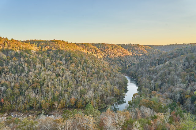
Big South Fork
Nov 1 - 4, 2020 (3 nights) & Nov 20 - 22, 2020 (2 nights)
2020 Bag nights: 28
Trailhead 1: Leatherwood Ford
Trailhead 2: Divide Road & JMT
Kids soccer was over and I was getting antsy. My mother was still in town helping with homeschooling the kids, so my wife said go. I've been meaning to get back to Big South Fork and this seemed like a good time.
I decided that I would check out some of the view points that I had seen before as well as a couple new ones. The weather forecast looked sunny but chilly/windy at night (highs in 50s and lows down to mid-20s).
I started at Leatherwood Ford and headed north on the JMT aiming for an overlook that I remembered passing 4 or 5 years ago. I was hopeful that I'd find a flat spot for a tent that was close to some views.
I enjoyed the views along the way, but the wind was gusting into the 30s and it wasn't super comfortable to linger.
Looking south at Big South Fork
Looking west-ish up Falls Branch
Cruising along the JMT
I got to my overlook and decided it would work. After another mile or so to get water, I returned and setup camp and waited for sunset.
The sunrise was nice
The weather was perfect, a great day for hiking with a little bit of color left in the leaves.
Small cemetery off the trail.
Looking down at Charit Creek Lodge
Stitch of 4 vertical shots
Jupiter and Saturn low on the horizon
Almost Full Moon setting
Hatfield Ridge Arch
Hiking south on the Sheltowee Trace
These features in the sandstone always intrigue me
Falls Branch Falls
Lone grave just off the trail
Another boring sunset
Big South Fork of the Cumberland down below
Mars in the east and a hint of the Milky Way to the north
I cowboy camped and woke up with my quilt covered in a layer of frost. As it got lighter, it was obvious where the moisture had come from
The second glory I saw this year. It turns out the shadow part is called a
Brocken Spectre
Angel Falls Arch
and then back to the car and home. So, a waterfall, a couple arches, an old cemetery, awesome weather and I only saw a couple people each day, but mostly felt like it was just me and the trees. Basically, this was a perfect couple of days.
*********************
A couple weeks later and my wife said go, so back to Big South Fork. This time I started on the west side on Divide Road. I headed towards the Muir Overlook hoping to find a place to set up camp, but it wasn't going to work, so I headed down to the clearing below.
I setup on the edge of the clearing near the creek, gathered wood for a fire and left my camera pointed at the stars for a bit.
Mars
Star trails experiment. I need to work on these.
The clearing is mowed by the park service to leave it like it was earlier. This is all that remains of the house.
Nearby is the family cemetery
Ranson Boyat's grave (a sad story
here).
After packing up, I decided to go bushwacking in an attempt to find Anderson Falls. I ended up getting close, but got cliffed out and had to retreat. I've seen a photo from the bottom of the falls, so I will have to make another attempt from a different direction.
I headed down towards the river and ran into a terrible/muddy trail from all the horses. The view of the river was nice though.
I looped around to Maude's Crack and climbed up to the plateau hoping to find a view to camp near.
Looking up the crack (the rope was nice at a couple points, but I did not really trust it) ...
... and down the crack
View from the overlook
Woke up with tons of clouds, but for a brief moment, the clouds lite up. I wish I had had a view to the southeast.
After a couple minutes, the sky faded again.
One last look from the Muir Overlook (the first night I had camped down below).
And then back to the car and home.


