Showing posts with label paddle. Show all posts

Friday, February 5, 2021

KY River paddle

 November 8, 2020

It was a beautiful day and my son had been pestering me about kayaking. He really wanted to go camping/kayaking, but I thought the nights/mornings would be cold enough to not be fun for him. So, we went paddling for the afternoon.

I have paddled a little bit on the Kentucky River, but I had never launched at the small ramp near Clays Ferry and I-75. So off we went. We headed down river, but there is not much of a current, so direction doesn't really matter. After a little paddling, we were past the houses on the shore and it felt a little more remote. 


I-75 bridge, almost back to the ramp.


November 28, 2020
I was looking for a long hike to burn off Thanksgiving. My youngest wanted to do something with Dad. There was not way she would manage a good hike, so we went paddling instead. 

Not a lot of photos, it was a lot colder and my feet had got wet launching the kayak so, after a couple hours, my feet were feeling pretty frozen. I asked her to stop paddling since we kept getting out of synch and I wanted to get back to the ramp. As we got close, I wanted to take a photo of the bridge reflections. As I pulled out my camera, I noticed that she was looking a little crooked. I took the photo and said that we were getting close and she jumped. It turned out she had dozed off for a bit :)

Thursday, August 22, 2019

Laurel River Lake and Kid #3

Laurel River Lake
Craigs Creek Boat Ramp
7/25 - 7/26/19 (1 night)
2019 Bag Nights: 10

The older two kids were still in camp and my wife had a short work trip, so kid #3 and I went on a short kayaking excursion to Laurel River Lake in Southern Kentucky. The weather was perfect, warm enough to swim, but not crazy hot as we were paddling.


Once we got to the White Oak Boat-in Campground, we sent up and then played in the water and watched the power boats go by.


There is a bit of a beach, but the lake level was really high, so the beach was pretty small. She still had fun digging and splashing.

There was an attempt at skipping rocks, she needs some practice.

Then we had dinner and waited for the stars to come out. We saw Jupiter and Saturn and a couple fireflies and a couple bats.


Next morning, we packed up and then paddled back towards the boat ramp, had a nice day and got home before mom. Super fun trip, we both agreed that next time we need to go for at least 2 nights.

Monday, November 12, 2018

Dad and son go paddling

Laurel River Lake
10/6 - 10/7/18 (1 night)
2018 Bag nights: 33

My mother in law was in town and there was no soccer, so I was planning on escaping for one night of solitude. It was still really hot (highs in low 80s), so I decided to revisit Laurel River Lake. I figured it would be hot paddling, but the lake was probably still warm enough to swim. Then last minute change of plans, my son said he wanted to go with me. He never got a solo trip with dad this summer like the other two kids, so I guess it was his turn.

We got on the water around 3 ...


... and had a one hour paddle to the White Oak campground. I aimed for the same spot where I had stayed before because there was a great "beach" to play on.

We both swam in the lake for a bit and then he started work on a fort with beer can towers on each end


Then we skipped rocks ...

... and gathered drift wood for a fire ...

... and waited for the stars to come out. The light pollution is terrible here and I don't understand where it is coming from, I guess Corbin to the south. No more astro-photography here. (Note: the light on the right on the water is a very large houseboat.)

We woke up to calm water...


 ... and he paddled by himself for a little bit while I enjoyed my coffee ...

... and then we packed up and headed home. I wish we could have spent a couple nights and explored the area a little more, maybe next time.


Wednesday, September 12, 2018

Dad and Daughter go paddling

9/1 - 9/3/18 (2 nights)
2018 bag nights: 32
Trailhead: Cable Cove boat ramp (Nantahala NF)

The kids started school in the middle of August and I started teaching at the end of the month. And soccer started which means I am now coaching 3 different teams, backpacking takes a backseat until November. But Labor Day weekend means no school on Monday and no soccer games on Sat or Sun. So, let's do one last trip to wrap up summer. I've been wanting to do another kayaking trip on Fontana Lake and I also wanted to take my oldest (9.5 years old) on a trip by herself.

A little bit of rain as we got close to the lake, but not too bad. We got to the boat ramp and got set up and launched at about 3pm with lots of clouds in the sky. About 5 minutes of paddling and the sky opened up on us with lots of wind/rain and some thunder. Thankfully the wind/rain was at our backs and after about 20 minutes of paddling we were out of the rain and not hearing thunder, but there was a stretch where I was questioning my judgement and wondering if we should head back to the ramp.


Looks good in front...

... not so much behind us

All smooth paddling now

Another hour or so of paddling and we had reached Site 81 in the GSMNP which was going to be home for the next two nights. Unfortunately, there was a boat already there and they (two men and two young boys) had taken the site closest to the water. We did not have much stuff and it is a short walk to the next site, so it wasn't a big deal, it just made it more difficult to easily enjoy the water view.

We setup camp and relaxed a bit and then my daughter mentioned that she wanted to play on the bear cables. In the past, she has has put her foot in the loop and I pull her up a little bit. I mentioned that she was getting too big/heavy for me to do this and we probably would not do it on our next trip. She then decided to try to pull herself up, I said go ahead but I did not think she was strong enough. The next thing I know, she somehow falls, lands flat on her back and knocks the wind out of herself. She landed hard enough that she was hyper-ventilating a bit and her lips started to turn purple. Scared me to death, but I got her breathing deeply and she laid in the tent for a bit and recovered. After a bit, she said she felt a little stiff and wanted to walk around a bit, so we wandered back to see the other people near by.

It turned out that they had taken the boat for a sunset cruise so there was no one to talk to. There campfire was still smoldering so I gathered a little wood and we borrowed their fire ring for a little bit. When they got back after dark, they were happy to see a fire already waiting for them.and we ended up sharing their campfire and talking for a bit before turning in.

The next morning I slept in a bit and then got up to read and leave her sleeping. She ended up sleeping until 9am. After a bit, we got back on the water. I had the idea of paddling a bit and then hiking to check out a couple of the old cemeteries. So, we paddled for about an hour and a half over to where Pilkey Creek drains into the lake. I had passed this way in March on the Lakeshore Trail, so I knew there was a road/path from the lake. We swam in the lake to cool off and then had lunch and then hiked about a mile up to Pilkey and Posey Cemeteries.


We talked a little bit about the history of the area and I told her what I had read about Decoration Days and then she spent a little time neatening things up a bit.

Pilkey Cemetery has about 30 grave sites, a lot are infants or young children, but one was a woman who lived to be 103 years old!

Posey Cemetery has 5 (or 6) grave sites, 4 kids (all born in the very early 1900s) and 1 adult (William Posey). There is another gravestone in the back that was also William Posey, but with a different birthdate, but same year of death. Somewhat odd, but William Posey died before any of the 4 kids were born and there are no other graves.

After relaxing in the shade for a bit, we headed back to the shore, where I jumped in again to cool off. Then we paddled back to camp and then she paddled the kayak by herself for a little bit while I read on the shore and took a couple photos with my camera.


The other boat came back and she helped the younger boy try to find worms for fishing, that occupied them for about a half hour and then he got a hot dog from his dad, still did not catch anything, but the two of them seemed happy. Then dinner and we again visited the neighbors and their campfire.

The next morning we took our time packing up but were on the water by 10, about an hour and a half later we were at the boat ramp. Not far out of the way was Tapaco Lodge, I had seen their sign mention pizza on previous trips, but had never stopped. This seemed like the perfect time to check it out. On a previous trip we had decided that we were going to celebrate  our backpacking trip with a "celebration pizza" and she wanted pepperoni and olives. So one "celebration pizza" and then a very long drive home with lots of holiday traffic and idiotic drivers.

When I asked her what she liked best, she said the cemeteries and the paddling. It was a great way to spend a long weekend. And a great way to end summer.

Sunday, September 9, 2018

Cave Run Lake

Zilpo Campground
7/26 - 7/28/18 (2 nights)
2018 bag nights: 23

We met some local friends for what is turning into an annual car camping trip (I think this was the 4th summer in a row). Our plans were to relax while the kids (we have 3 and they have 3, all under 10) played together and swam in the lake. I also brought my inflatable kayak for them to play with.

I had done a little research, so we ended up with two sites next to each other with very easy access to the water. It made for a very relaxing couple of days.


Our own private beach

The kids had fun swimming ...

... and paddling the kayak, at one point all 6 kids managed to squeeze in

Waiting for the stars


Woke up to a foggy sunrise


A very relaxing way to spend a couple of days.

Friday, July 6, 2018

Stockholm Archipelago

5 day kayak trip in the Stockholm Archipelago

5/28 - 6/1/18 (4 nights)
2018 bag nights: 10

Most of this post is for my memories, but I had a hard time finding much information about actually paddling in the archipelago so maybe this will help someone else. My goals for this trip were to explore/see as much as possible and to avoid people. I was worried that the inner archipelago would be crowded, but I barely saw anyone (one kayaker and a couple sailboats and motor boats) the whole trip. I think it was a bit early in the season, since it appeared that most of the vacation houses were unoccupied.

Something to consider in planning a trip like this. While you can camp almost anywhere you like because of the "Right of Public Access" a lot of the shoreline is very steep and almost always rocky. This means that actually getting ashore is frequently difficult or even impossible. Don't just look at a map and assume you can camp on any island.

I rented my kayak from HORISONT KAJAK - https://horisontkajak.se/en/
The Archipelago Foundation owns a lot of islands or parts of islands all over the archipelago.
I was near three of the foundations nature preserves. There is a map as well as a little bit of info about the area on each page
MöjaskärgÃ¥rden - http://archipelagofoundation.se/omrade/mojaskargarden/
Gällnö - http://archipelagofoundation.se/omrade/gallno/
Hjälmö-LÃ¥dna - http://archipelagofoundation.se/omrade/hjalmo-ladna/

Photo of nautical chart from the kayak place, I was glad to have rented it for the trip, but I was also glad to have my phone with GPS to help figure out where I was since low down on the water the islands tend to blend together and make channels hard to see. My regular phone broke a couple days before the trip so I used an old phone with Backcountry Navigator and maps already loaded. The Open Street Maps of the area worked great. Supposedly, there is cell service over most (all?) of the archipelago, but I did not get a SIM card for my old phone. Probably a good idea to pre-load maps ahead of time. 


Day 1: 6.5 miles
Day 2: 9.5 miles
Day 3: 7 miles
Day 4: 12.5 miles
Day 5: 7 miles
Total = approximately 40 - 45 miles

In general, I paddled about 6 hours a day. I was very happy to find places to walk when I was done paddling for the day. I would suggest avoiding camping on the truly small islands unless you are very happy just sitting with a book. I'm a very happy reader, but I also get a little stir crazy if I sit too long, having rocks to climb on or a path to hike was very nice each night.

Something else to consider, the sun rises around 4:30 am and sets around 10 pm in early June. You could easily paddle early in the morning before the wind picks up, take a long lunch break and then paddle in the late afternoon. Even when the sun sets, it is not really dark. I only used my headlamp to read, so it would be easy to be setting up camp at 10 pm.

Overview map, Stockholm is off the map to the left


Jet lagged in Stockholm, the whole family went for a little bit of exploration and food. There was a large bush covered with these flowers in one of the parks.

The next day I had about a one mile walk to the bus station and then about an hour ride, followed by a 3km road walk to get to the kayak rental place. The weather was nice so it just felt like an easy hike. I got to the kayak place about 1pm and found out that they did not sell denatured alcohol for my catfood stove, must have been the other kayak place that mentioned it on the website. The lady in charge was nice and set me up with a gas stove so I was able to heat water for breakfast/dinner. I filled my water bottles and loaded up the kayak and away I went.

I headed basically north across the main channel directly into the wind. It was strong enough that waves were breaking across the bow and for a little bit I wished I had rigged the spray skirt. the paddling got a lot easier once I got out of the channel and into the shelter of some islands. I was very glad to not have to dodge any large ferries or other boats as I was crossing the channel.

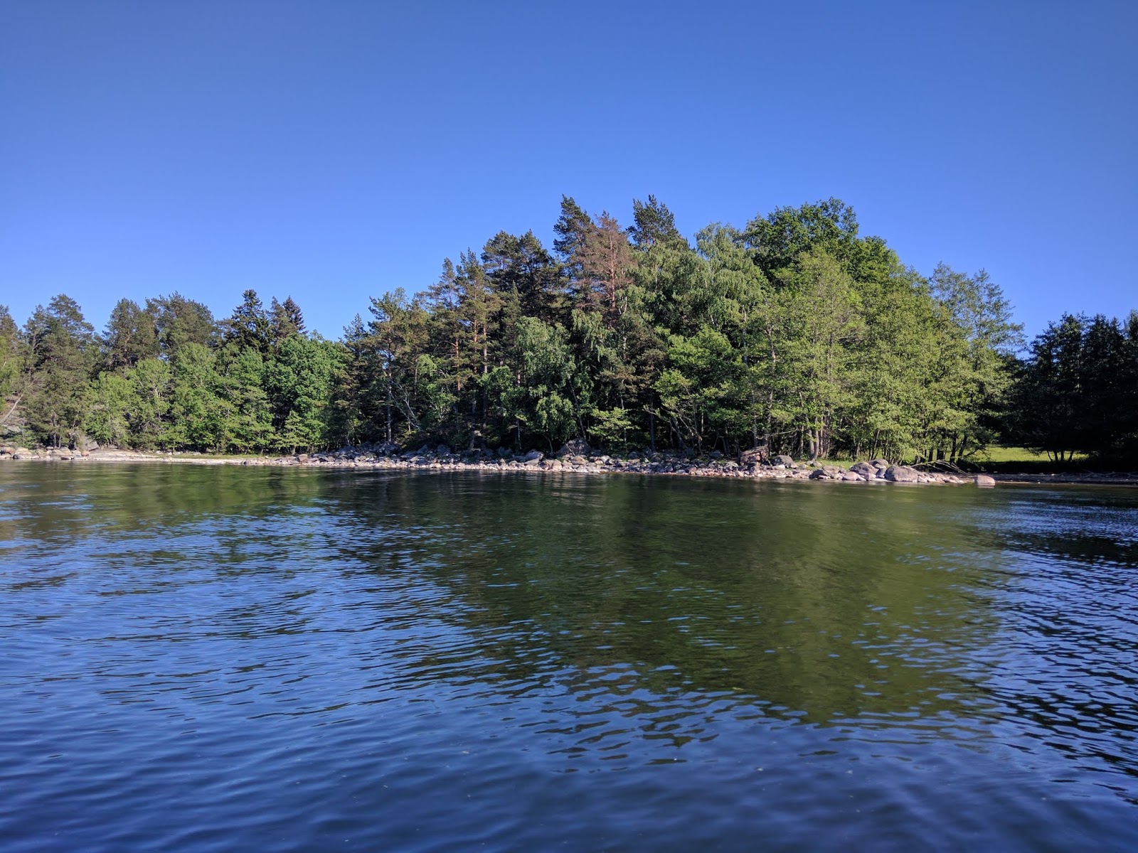
I weaved my way through the smaller islands near Gallno with no real destination in mind.


I paused to rest/stretch a couple of times.


One place I wanted to check out was the water well on the north part of Gallno. I had plenty of water for the first couple days, but would need to be careful if the wells were dry (supposedly there had not been a lot of rain recently).

This is the view from the beach where the well is located. There was a sign in Swedish attached to the well pump. I don't understand Swedish, but something about it made me think it said to boil the water for 3 minutes (I wish I had a photo).

There is a trail going both north and south from the well. I headed north to stretch my legs a bit, very pleasant walking with minimal bugs.

Then I paddled a little more until I found a place to set up camp near one of the Foundation outhouses on the island of Lisslo. There was an obvious path that I followed across the island past a couple of homes, but I did not see anyone.


I woke the next morning to glass-like water. After paddling for about an hour I started wishing for a little bit of a breeze to cool me off.


After paddling for about 6 hours with a lunch break and a couple miles walking on the road on the island of Sodermoja, I arrived on Granholmen where I found five very curious sheep in the field near the water well. This made me nervous about the quality of the water here. I still had enough until the next day, but I need to figure something out since I wasn't sure I had enough fuel to boil water for the rest of the trip.

In the meantime, I followed the path south through the field and into the woods. There was a stretch where the trail was blazed with teddy bears ...

... and baby pacifiers.

There were quite a few wildflowers along the way.


Then back to a very nice campsite for dinner.

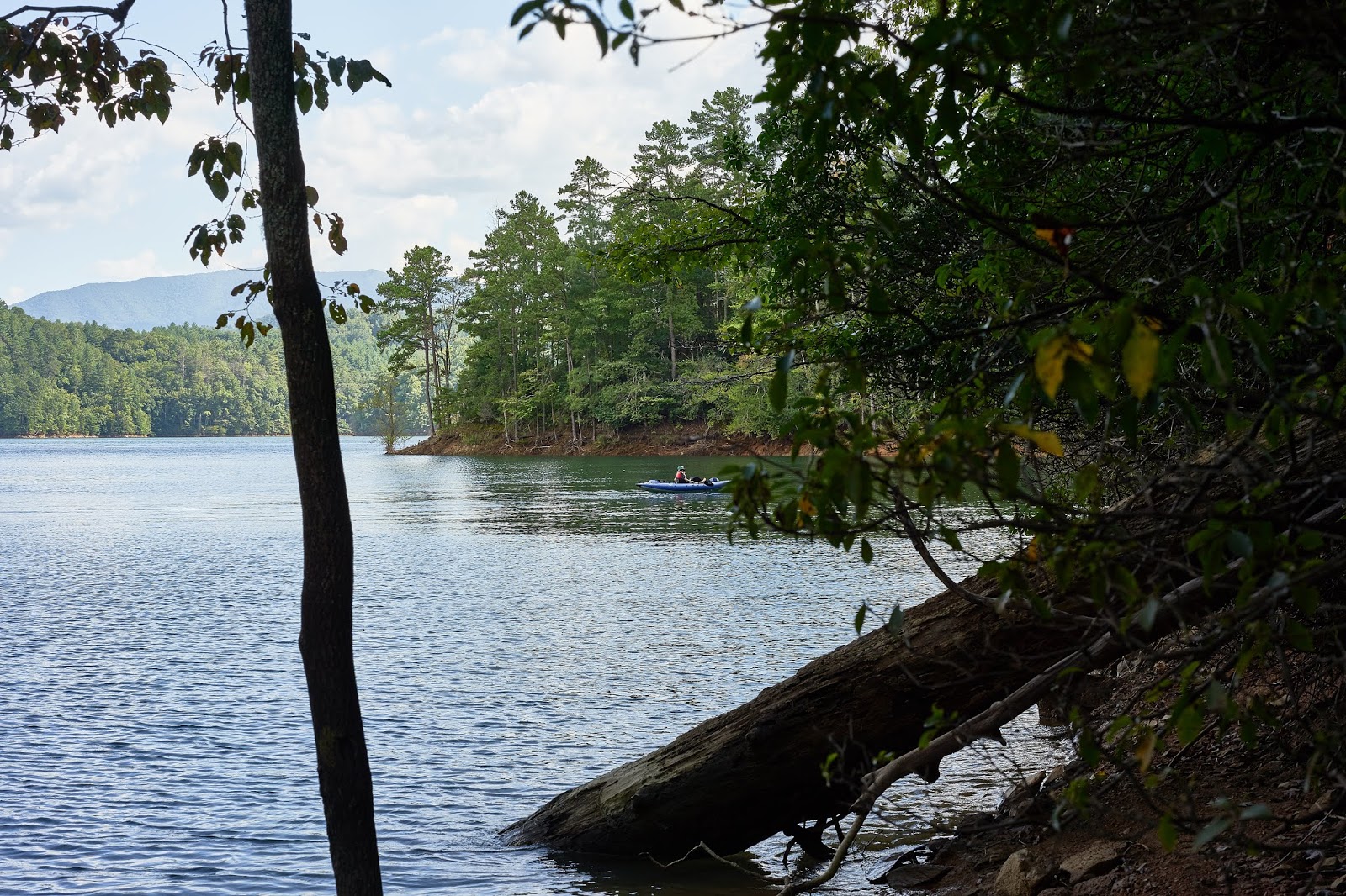
After dinner I took a short paddle in the little bay and explored a nearby island, ...


... then headed back to camp to climb around on the rocks and wait for sunset (about 10pm).


I can't figure out which of these 3 photos I like best, so I posted them all.


The next day I decided that I would fix my water situation by heading to Berg on the island of Moja since I knew there was a grocery store there. Unfortunately, the wind had picked up and I was heading straight into it.


The wind wasn't bad on the lee side of the islands.

I took a break on Ostholmen near the sauna where I managed to slip trying to get back into the kayak. Thankfully the Baltic wasn't freezing, but I did not want to linger in the water. After drying off, I headed to Berg.

I got water and some bread and cheese in the grocery, checked out the church, ...


... and got back on the water. This lighthouse is in the channel south of Moja and east of Berg

I took a late lunch break on the north shore of Bocko-Storo and when it was obvious that the wind wasn't dying down got back on the water to continue into Mojaskarden.

I found an inlet that looked like a good place for the night.

I set up camp and went to explore. There was an obvious path along the rocks that lead east to the middle of the island and a large inland lake.


At the end of the inlet. My camp was at the end on the right.

I liked the look of this tree, even though it has been dead for years, it still looked "majestic"

No view to the west for sunset, not to mention it was still really windy. I chose to hunker down out of the wind and enjoy some bourbon and a book.


The next morning the wind had wasn't blowing as hard, but was still there. It was time to start making my way back towards home. Originally I had wanted to explore the outer parts of Mojaskarden, but that would have meant paddling straight into the wind again. I decided to head south in the channel between two islands and then east back towards home.

The only hard part of the day was the ~2.5 miles across open water. As I was starting the open water paddle, a seal popped up very close to the kayak. He stuck his head up a couple times, but I was never able to get a photo.

After paddling towards the west for a couple hours, I was across the open water and back among islands and sheltered water. Around 6pm, I started looking for a campsite. I was closer to Stockholm and there were a lot more houses around. I stopped for a break on an island that looked promising. In my explorations I found a perfect sand beach near a swing-set but away from any houses, so I decided that would be home for the next 12 or so hours.


After dinner, I climbed on the rocks and explored the island a little bit.


One of the home owners clearly liked building stuff. There were a couple small boardwalks and this bench.


Last day, perfect weather, a couple of hours of paddling and I was back.

This was a great trip with perfect weather, highs in low 80s farenheit and lows in the upper 50s or low 60s. The mosquitoes only bothered me on the second night and that was after the sun went down. Also, I never saw a tick and supposedly the archipelago is crawling with them. I think that I got lucky with weather. From what I heard, it is usually cooler and wetter in the end of May. 

Knowing what I know now, I would probably start in Berg and just paddle in Mojaskarden. I saw kayaks for rent not far from the ferry dock and grocery. I suspect it is not much harder to get from Stockholm by ferry to Berg vs. by bus to where I started. 
I found this link http://www.mojahavskajaker.se/22208692 for kayaks in Berg. But, I was very happy with my experience with Horisont Kajak