12/26 - 12/30/15
Trailhead: Fontana Dam
Trails: Lakeshore Trail => Hazel Creek => Welch Ridge => AT => trailhead (~55 miles)
Campsites: Lost Cove (90), Bone Valley (83), Silers Bald shelter, Russell Field Shelter
I have wanted to retry my failed trip from
January when my knee cut short my trip. But, I did not want to drive through Pigeon Forge or Gatlinburg and I did not want to deal with the potential of bad weather trapping me in the parking lot at Newfound Gap when I got back. Given this, I decided that I would start at the Twentymile Trailhead and essentially do the same loop but leave off the Clingman's Dome leg.
However, the weather leading up to the trip was very unusual (warm and wet) and the area had flood warnings. According to the
High on LeConte blog the mountain had got 6 inches of rain in the previous 5 days. Since my planned trip was going to involve the Lost Cove trail on the first day and that is one of the trails with a high water warning, I decided to change my plans a little and start from Fontana.
Day 1 (12/26): Fontana Dam to Site 90 (5.6 miles)
I scarfed a sandwich stuffed with leftover turkey from xmas and a couple gingerbread men on the drive down. I got to Fontana around 1:00 and the thermometer in my car said 70, it was partly cloudy and humid. Got my stuff situated and headed over the dam to the trailhead. Walking across the dam, I looked up and noticed the fire tower on Shuckstack (hard to see, but it is right in the middle of the picture below), planned on walking past that in 6 days.
Got to the actual trailhead and headed up the Lakeshore Trail.
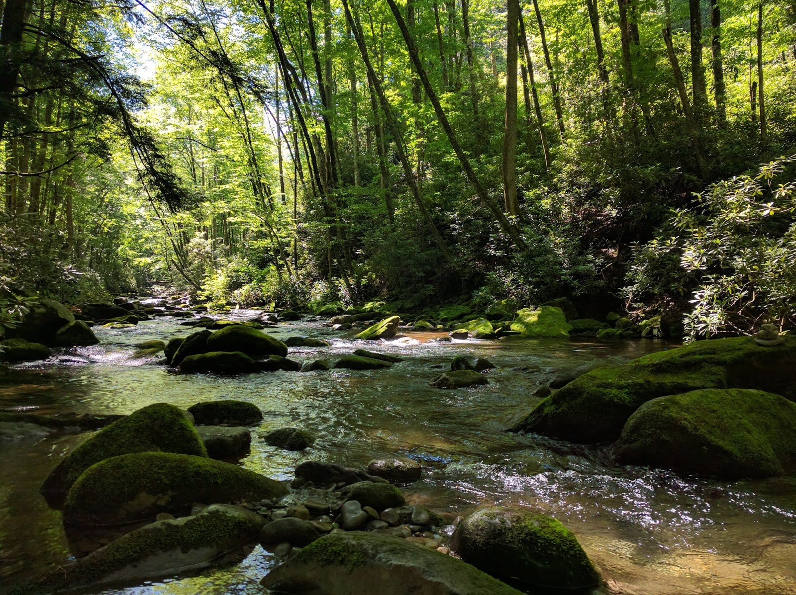
Within 5-10 minutes, it was obvious this was going to be a wet foot trip. What would normally have been a rock-hop of a stream crossing was now a calf deep 10 foot wide creek. No point trying to stay dry, dive right in. There were 3 or 4 more of these in the next mile. At this point, I was glad I avoided the Lost Cove trail.

I passed the old cars. I wonder what happened to these cars, were they broken down before the dam or did they break on the way out and were just abandoned?
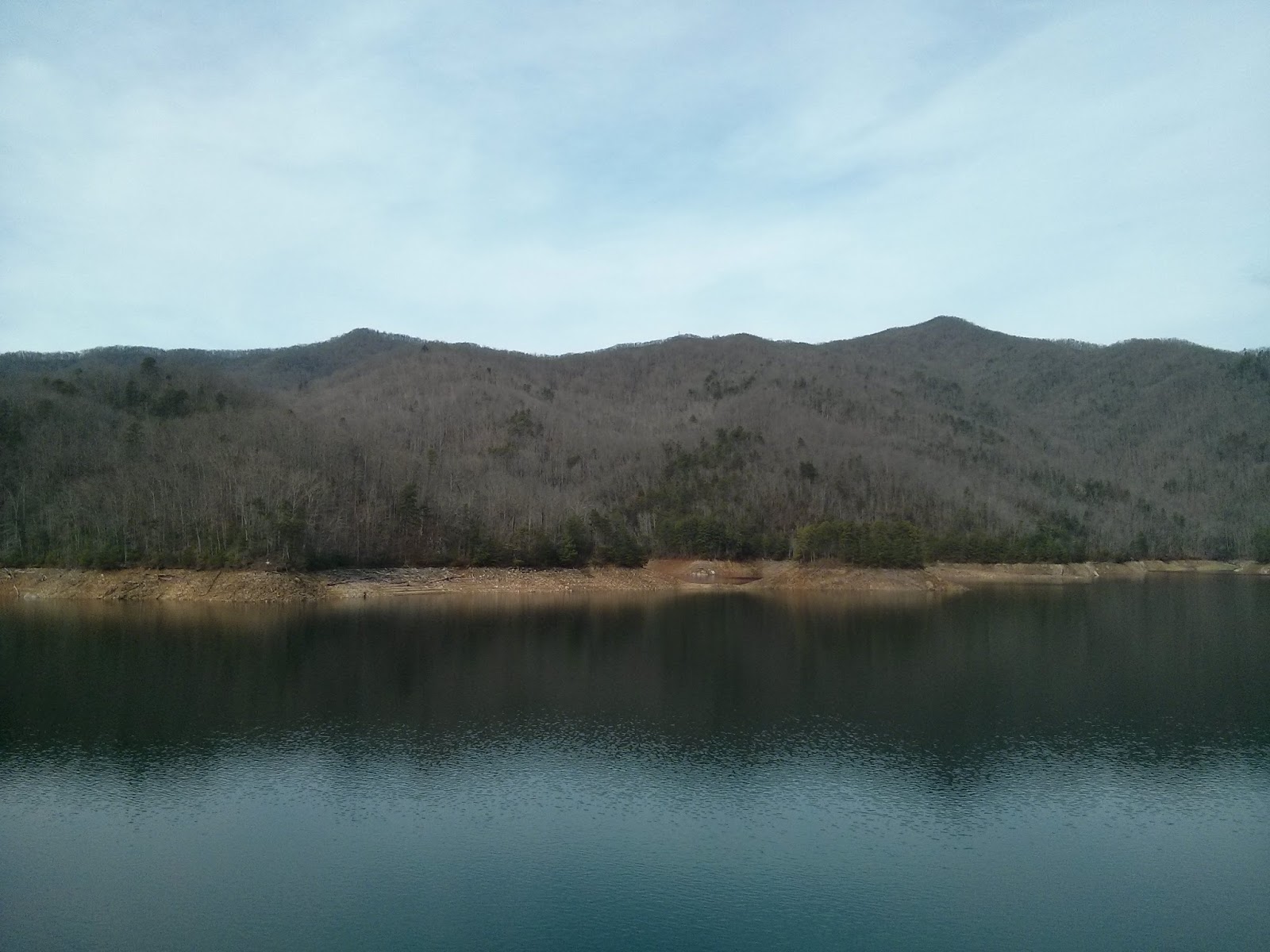
The occasional view of the lake
I got to the campsite around 4:30. Walked around a little bit, checked out the view from the "beach" and shook my head at all of the crap in the big fire ring, got my hammock set up and found some dry wood for a small fire. While eating dinner, I realized that I was feeling a little dehydrated, the temperature and humidity were a bit ridiculous for the end of December. I put out the fire around 8 and crawled into bed to read for a bit.
Day 2 (12/27) Site 90 to Site 83 (4.9 miles to Hazel Creek and then 5.2 miles to Site 83)
The moon was a day or two past full and was very bright when I got up in the middle of the night. Woke up to a very nice morning, had breakfast and headed down the trail.
A piling from an old bridge near the current bridge across Eagle Creek.
The Bridge across Eagle Creek, lots of water coming down the creek.
There was one small climb over the ridge and then mostly downhill towards Proctor. Lots of sunshine means shadow selfie, high was probably close to 70 again, good day for hiking.
Old home sites near campsite 88, getting close to Proctor
Kind of hard to tell, but the creek along here is lined with a rock wall, lots of work to build.
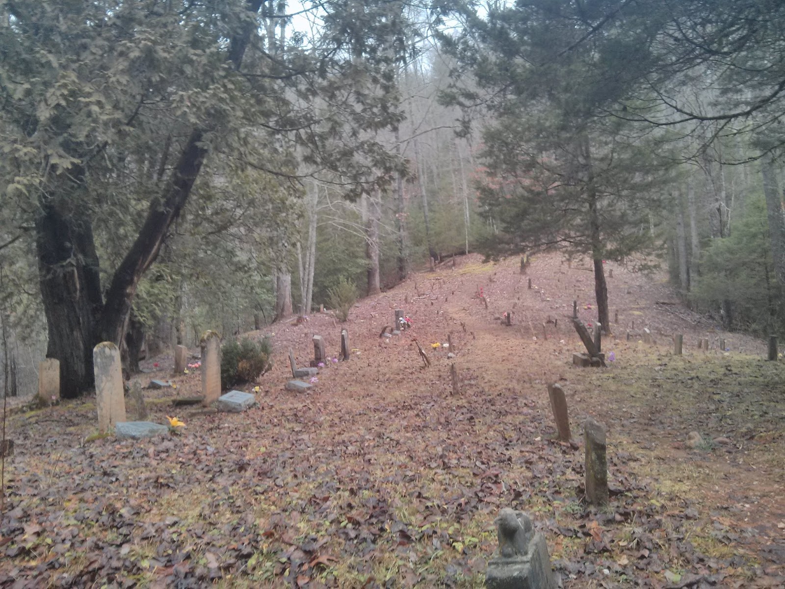
A couple of years ago when I did the Lakeshore Trail, I was unaware of the history of the area and so did not take any of the small side trails to the cemeteries. This time, I checked out the two that are west of Proctor.
According to the topo map, this is the Bradshaw Cemetery, up on a hill with a steep 200 foot climb.

I find it interesting and sad how many children did not live to see their first birthdays. I can't imagine what this family dealt with to have two infants die a little more than a year apart.
Here is the Proctor Cemetery, just outside of town.
The graves of Patience and Moses Proctor, first settlers in this area.
A home site just outside of town on Hazel Creek
I had a break on the porch of the Calhoun house
You can just see where the Lakeshore Trail continues across the bridge across Hazel Creek
and then headed up the Hazel Creek trail. The first 8 or so miles are very easy "road" walking.
The trail crosses the creek a couple of times, thankfully, there are bridges.

I got to campsite 83 around 3 and set up camp. One of the reasons I wanted to come this way was to see the Bone Valley trail, part of my fascination is how remote the trail is, smack dab in the middle on the park, with a long hike to get there. I also wanted to see the old house ruins and the small cemetery at the end of the trail. Round trip it is a little more than 3.5 miles so I figured I could be back before it got too dark. So, I headed up the trail to see what I could find. I knew there would be creek crossings, but my shoes were already wet so that did not bother me. I did not have my pack, so I made sure my phone was sealed up and waded in. The water was quickly up to the bottom of my shorts and getting deeper and moving fast enough to make me nervous. Once again, I wished for hiking poles. This wish was going to be repeated a lot on the next day. I decided that I did not really feel like swimming in 50 degree water and postponed my trip to Bone Valley for another day. Instead I checked out the Bone Valley cemetery (which is just up the hill from the Hazel Creek Trail) and then headed back to camp where I took advantage of the remaining daylight to read a little and then had dinner and another early bedtime.


Day 3 (12/28) Site 83 to Silers Bald (9.5 miles to Welch Ridge and then 2 miles to Silers Bald)
Woke up to a hard rain that thankfully turned into a light drizzle. Broke down camp and heated water for oatmeal and coffee under the tarp and then headed up Hazel Creek. I had thoughts of breaking camp and eating breakfast on the porch of the park bunkhouse (visions of the Calhoun House in my head) and then thought, what if there is not a porch? Good thing I did not plan on a porch :)
The trail goes right through this "creek", I suspect with normal amounts of rain, this would have been an easy rock hop across, not today though. There were a couple more of these and then the trail got worse, more on that in a minute :)
There is a point where the trail comes to what is almost a "T", the left side (going north on Hazel Creek) winds through the woods and eventually comes to this bridge, not long before this point was a no horses sign making me think it eventually comes to a cemetery. I decided to save exploring this trail for another day. Looking at Caltopo, the trail is not there, but I think this bridge is crossing Brushy Branch.
Eventually, the Hazel Creek Trail goes from a road to a "trail". On the map this is the point where it switches to "no horses".
Not long after the log bridge, the trail fords Hazel Creek. The creek was moving fast enough that I wasn't going to attempt to walk through, so a short bushwack brought me to this log (crappy pic) that I scooted across on my butt.
This turned out to be the start of
type 2 fun. This whole section would not be so bad if I had someone to share the misery with, someone to say "Hey, remember that ridiculous day on Hazel Creek? We should do that again". Not too many pictures were taken, because it had started to drizzle and there was a ridiculous number of creek crossings, did I mention that the water temperature was probably low 50s? Every little rock-hop of a crossing had turned into a roaring torrent of water and the ones where you would normally be ankle deep were up to my shorts. I eventually found a stick to help me keep my balance in the water. This was the second trip this year that I wished for hiking poles. The first time was all of the fords of Slickrock Creek. This was on the same level, each crossing was easier than Slickrock Creek, but there were twice as many of them. When there weren't actual crossings, there was water running down the middle of the trail or the trail was running down the middle of the water, it was kind of hard to tell which was which.

It was a hard couple of hours, after a while, I started to look forward to the 2000 foot climb that was coming because I knew there would not be any more creek crossings. I eventually made it to the cascades and then could not find the continuation of the trail.
Eventually, I got across the creek and headed up the slope towards Welch Ridge.
As I got higher, the views started to open up and the wind started to pick up.

I eventually made it to Silers Bald, where it was misty/moist and the wind was really blowing(I saw some backpackers the next day who said their NOAA weather radio said 65 MPH gusts). No thought of hanging my hammock (not supposed to at the shelters anyway). With the wind, I'm not sure I could have strung up my tarp anyway. I had been hoping that there would be people at the shelter and they would have a fire going in the fireplace, but that was not to be. In fact, the little bit of wood in the shelter was pretty damp, I wanted a fire, but there was no point in trying with the wood that was there. So, I got water for the night and I huddled up in the shelter, spread out my stuff and proceeded to read with my headlamp (Note: it was about 3pm but already getting dark, the shelter faces east, so that wasn't helping either). While I was reading, one of the shelter mice came over to check me out. I threw a flipflop at him and he ran away.
Day 4 (12/29) Silers Bald Shelter to Russell Field Shelter (14.8 miles)
Today is the only day I saw anyone on the trail. I passed 2 backpackers, a solo backpacker and 4 young guys all heading towards Newfound Gap. I ran into one woman at Derrick Knob Shelter heading towards Fontana (going my direction).
The wind died down sometime during the night. At one point, I rolled over and noticed that it looked pretty bright outside, must be the moon I thought, hopefully a nice day in the morning.
Woke up to blue skies and sunshine and cool temps.
I started out with my fleece but shed that after a couple of miles. The day ended up being perfect t-shirt and shorts weather, small scattered clouds and lots of sunshine, highs probably about mid-60s. Great day to be hiking on the ridge line.
As expected, the hard part of the day was the climb from Starkey Gap to Brier Knob. Everyone talks about Thunderhead and Rocky Top being steep, but I hated the Brier Knob climb in January and I did not like it anymore now. I eventually made it to Rocky Top around 2 and decided to take off socks and shoes and dry my feet. It turned out I had a truly awesome blister on my big toe, very surprised that I had not noticed it, nothing a knife and some Leukotape couldn't fix.
I enjoyed the view, ate a snickers and drank almost all of my water and then it was time to continue down the trail. I got to Russell Field around 4:30 and had a decision to make. I had already decided that I did not want to deal with the rain that was forecast for tomorrow so I was going to skip Gregory Bald and just follow the AT back to Fontana. I was trying to decide if I should hike the next couple of miles to the Mollies Ridge Shelter and be that much closer to my car.
In the end, what made me decide to stay was the 2 young kids who were there had gathered wood and were set for a fire. Even though I had finished my bourbon the night before, I thought a fire might be nice.
I enjoyed dinner while the sun went down. The sunset was nice. Today totally made the previous day worth it.
Day 5 (12/30) Russell Field Shelter to Fontana Dam (13 miles)
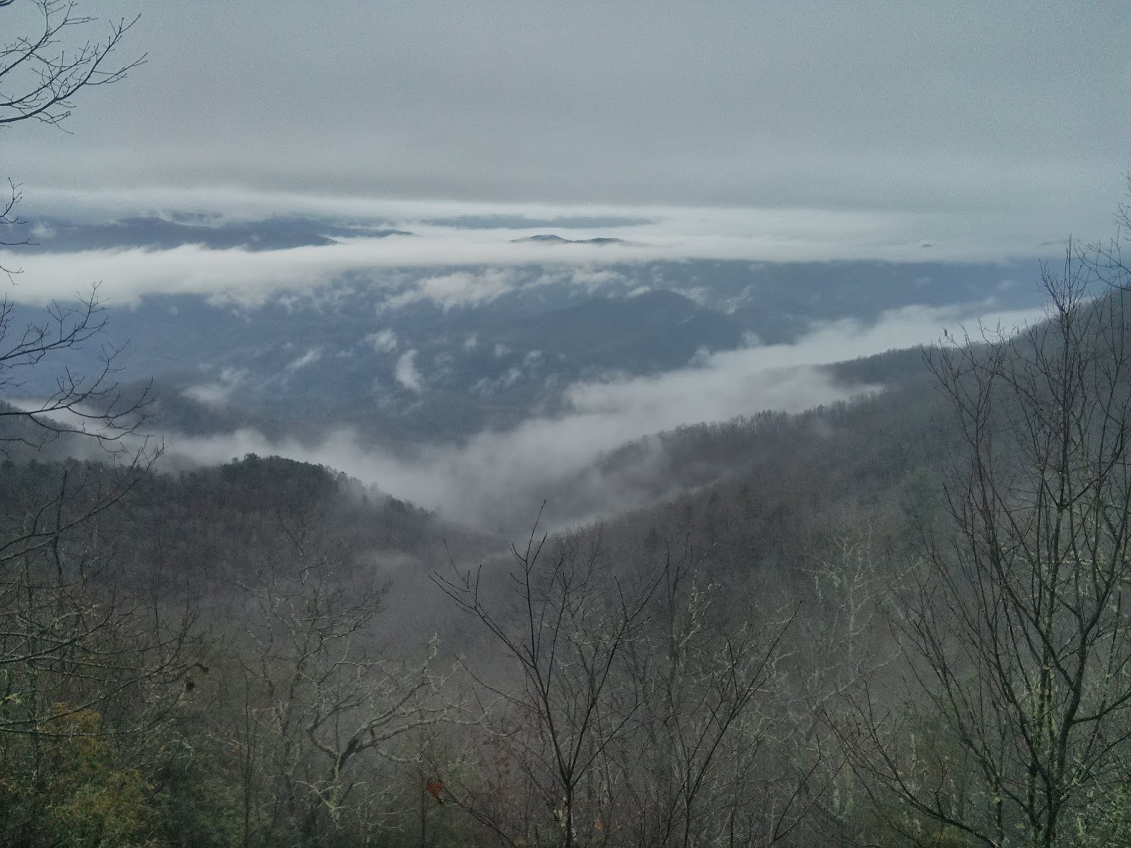
Pouring rain on the roof woke me up at 7. Thankfully, it was just a light drizzle by the time I hit the trail. Put on my rain jacket to walk down and get water, I only had flipflops on so I was concentrating on not slipping, i.e. watching my feet. I heard a huff/growl and looked up to see 2 bears about 100 feet up the hill headed in the other direction. I made some noise and continued on to get water. Even the drizzle disappeared in the first half hour and then it was just walking through the clouds for the rest of the day.
I bypassed Shuckstack since I figured there was no chance of seeing anything. A little while later it appeared that the clouds were breaking up a bit and I wished I had taken the time to climb up to the base of the tower. Well, it was a nice view from the trail.
A little more gray crossing back across the dam compared to the first day.
No chance to see Shuckstack today, but I am pretty sure it is up there.
Car thermometer said 57 at 2pm confirming the weirdness of the weather.
All in all, a great bookend for the year. First trip in January was nice weather in the Smokies and last trip in December was nice weather in the Smokies and this time, no knee problems. I can't wait to do it again.