Showing posts with label deer. Show all posts

Saturday, November 25, 2023

Dolly Sods

Dolly Sods (WV)
7/30 - 8/2/23 (3 nights)
2023 Bag Nights: 10

CalTopo says about 27 miles and 3000' of elevation

Book: The City and The City by China MiƩville (I clicked on the wrong title on my Kindle and decided that maybe I was "supposed" to read this book on this trip. Ended up being an awesome backpacking book. Slightly weird and highly recommended.)

My wife took the kids for the annual grndparents visit. Normally, I would have headed for the Sierra, but I had a trip planned for Yellowstone in another week. So what to do while I'm home alone? Haven't been to the Dolly Sods in a while.

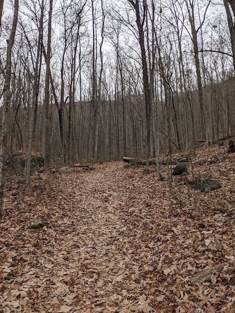
I started at the Red Creek Trailhead about 3pm with the idea of a couple miles to camp. I had never been up the Little Stonecoal Run Trail, so that sounded like a good way to start. All of the trails from Red Creek gain a lot of elevation, some of them do it all in a short distance. The Little Stonecoal gains about 1000' in about 1.5 miles, so a good start to the trip. 

Crossing Red Creek on a beautiful day

I had a pretty good idea where I was aiming for the first nights camp and a couple hours later, I was there. 

Night 1 camp

Remains from logging


Camp visitor

Stonecoal Run

Some reflections in the creek ...

... and clouds in the sky

More reflections


Next morning, heading north

Large beaver dam on the edge of the trail, no signs of the builders

Near a favorite lunch spot overlooking Canaan Valley


Along Dobbin Grade Trail, this lake wasn't hear the last time I passed through ...

... The beavers have been working. Someone has routed the trail across the top


I followed a new to me user trail up the ridge to a dry camp and then fetched water down the hill. 

Night 2 camp

I was hoping for a nice sunset, but the lack of clouds made it not very photogenic


The next morning was very hazy, but I did not think too much about it. 

Canaan Valley

Blueberries

Cabin Mountain

Very hazy, a little weird

Old road around Dobbin Slashings


Back on the Dobbin Grade Trail and a little bit of mud

Dobbin Grade Trail has lots of stretches like this

Night 3 camp above Upper Red Creek


About this point I realized that the haze was smoke, probably from Canadian wildfires, maybe a good sunset?


Way to hazy for a nice sunset, the sun just sort of disappeared as it got close to the ridge. 

Next day back to the car and then drive home and get ready for Yellowstone

Saturday, February 11, 2023

Cumberland Gap

Cumberland Gap National Historic Park
Civic Park Trailhead (Ewing Trail)
12/1 - 12/3/21 (2 nights)
2021 Bag Nights: 41


My original intention was to do an out and back from the visitor center along the whole ridge along with an extra night. But when I tried to call about permits and water sources, the phone system/voice mail wasn't working. I got to the visitor center and found out that all of the designated campsites along the ridge had been closed because of bear activity. The only site open was the White Rocks site at the far end of the park. Oh well, change of plans. 

I drove over to the Civic Park Trailhead and headed up the trail. The trailhead is on the right hand side of the map with the gap on the left. 


The trailhead is on the far lower right side of image. 

A couple miles and 1700' up to the ridge. 


I headed over to Sand Cave, very impressive. 

Interesting rocks on the ceiling


Me for perspective, very big

I headed up to White Rocks to check out the sunset, but it was very cloudy and very windy. I did not stay long and headed back to camp and a fire for the evening. 


Next morning it was again overcast, no sunrise so I lingered in camp with coffee and then headed to Hensley Settlement. It turned into a beautiful day for hiking along the ridge. 

Hensley Settlement is a preserved "village". According to Wikipedia many people left during WW2, only a couple were left after the war. Wikipedia


I ate lunch and enjoyed the rocking chair on the porch of the ranger cabin (no one was there).


Blacksmith tools through the window


I see you

Back to camp and then up to White Rocks for a better sunset.


I headed back for a sunrise view the next morning


And then back to pack up camp and back towards the car. I headed down the trail with a detour planned. The USGS map shows the location of an old firetower not far from the current trail. I figured it would make for a fun little excursion vs rushing to the car. 

There turned out to be a sort of trail heading in the right direction. I found the old foundations of the tower and the benchmark without much trouble. 

Foundation (concrete and rebar)

Telephone or telegraph pole

More foundation

And then down the trail to the car.

Good trip, definitely not what I planned. Not sure I will return since almost all of the ridge has no views and you have to camp at specific sites.