Tuesday, August 20, 2019

Red River Gorge Veranda

Jun 3 - 4 2019 (1 night)
Red River Gorge (Daniel Boone NF)
2019 bag nights: 4

I wanted to test out a lens for astrophotography and got permission for a quick overnight trip. At the last minute, my wife suggested I take my son for some boy's time, sure why not since I was not planning on anything hard.

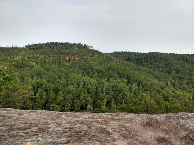
We had an easy hike to "The Veranda" where I was a little disappointed to find a solo camper already set up. I figured I'd have the place to myself in the middle of the week. He had a hammock so was back in the trees while we setup the tent near the end and a nice view. I talked to him a little bit before dinner and probably would have chatted more, but this was supposed to be "boys time" with my son.


Texting mom with my InReach

Afterglow from the sunset, this is looking east towards Hansons Point


My son went to bed and I watched the stars and had a splash to drink, but it was pretty obvious that the clouds were going to ruin astrophotography.


I left my camera set up to take photos all night. There was enough humidity that the lens ended up coated with dew by the morning, but you can still see the milky way rising here (about midnight).

We woke up and made a small fire in an existing fire ring. He had hot chocolate and I had some coffee.


While packing up the tent, we found a small praying mantis which he thought was pretty cool. 

Then one last photo ...

... and down the trail 


Grays Arch, notice my son in the lower right corner for scale.

Then pizza at Miguels and home. Note: we don't usually drink soda, but this was a "celebration". He wanted Sprite but they only had Mountain Dew. I told him that I loved it when I was his age (can't stand it now). So his first Mountain Dew, he thought it was awesome and mentions it all the time. I think he needs to go backpacking again if he wants some more :)

A great trip with my son, I'm glad my wife suggested that I take him.

Citico Creek Wilderness

May 20 - 21 2019 (1 night)
2019 bag nights: 3

The weather forecast looked reasonable, i.e. not too hot at higher elevations and not stormy. I had family permission to disappear for a couple nights. So, I decided to check out the Citico Creek Wilderness (TN) which is on the TN/NC border and next to the Joyce Kilmer/Slickrock Wilderness (NC). I've been to Joyce Kilmer a number of times, but never spent much time in Citico Creek.

I started at Beech Gap on the state line and had a short hike to Bob Stratton Bald. The forecast for the bald was lows around 50 and highs around 70, basically perfect hiking weather. I set up my hammock and wandered around a little bit. I had camped here before and was planning on getting water from a small spring on the edge of the bald, but it was mostly dry and muddy. So I hiked back about a half mile to a better spring. Then, I cooked dinner and wandered around some more. A family appeared and ruined my hopes for mid-week solitude, but they were nice and I told them where the good spring was. They ended up camping up in the trees on the edge of the bald and I did not see too much of them.

I laid in my hammock and enjoyed the view for a bit and ...

... waited for sunset ...

... the clouds mostly disappeared, but the sunset was still nice and ...

... I waited for the stars. The milky way was not going to come up for a couple hours and it was close to a full moon, so I wasn't planning on much astrophotography. I was just enjoying the view. I laid in my hammock and watched the moon rise and fell asleep.

It was a little chilly overnight, but I woke to another beautiful day.


Interesting flower

I wanted to explore the wilderness and had plans to hike north on the Fodderstack Trail and loop back on other trails over the next couple of days. There is a waterfall (Old Goat Falls) mentioned in the guidebook for the area, so I headed down the North Fork of Citico Creek to find the falls. I did not have the book with me but I knew it was close to the Fodderstack Trail. It was only about a mile down the trail, but it ended up being ~1000' lower. The falls weren't that impressive/not worth hiking down for, but once I was there I decided to keep heading lower and then would connect with another trail to head further into the wilderness. 

Old logging/railway stuff

The trail is pretty easy to follow, but a little overgrown ...

... and as you get lower, the trail gets wetter ...

... and wetter. Unfortunately, as I dropped further down from the ridge, it also got a lot warmer. Instead of low 70's, it was more like mid-80s and very humid.

I was beginning to regret dropping off the ridge and then I saw this in the middle of the trail. I still hate snakes.

And then not much later I slipped and fell on a rock crossing in the process banging up my knee and opening a nice cut on my shin. And then, I saw another snake (different species).

At this point, I was soaked with sweat, my knee and ankle hurt and I had blood dripping down my shin. The good news was I had not seen anyone since I left the bald, the bad news was I was not having much fun. I looked at the map and realized that I could connect the North Fork with the South Fork and aim back towards the car and I could make a stay or leave decision later. As I got closer the the lower trailhead/intersection the bugs began to get worse and that pretty much made up my mind.

There was a stretch with a lot of mountain laurels blooming, so that made me happy, but the bugs made them hard to really enjoy.

I went from the North Fork Citico to the South Fork Citico to the Jeffery Hell Trail and then to the road and walked the road the last 1.5 miles and 500' up. All in all it made for a long day ~17 miles and ~ 5000' down and 4000' up. I was very happy to see my car, but then had to drive the 4 hours back home. A very long day. 

I decided that late fall through early spring is my ideal time for this area. I'd rather deal with cold and wet vs. hot and humid. And the snakes are all hibernating :)

Dolly Sods Spring

Dolly Sods Wilderness
March 11 - 13 2019 (2 nights)
2019 bag nights: 2

I had permission to get away for 4 nights over my spring break. The weather looked cold and dry in the Dolly Sods, so I decided to head back there with the hope of nice views and some stars. I assumed that FR 75 was gated for the winter and I did not want to ford Red Creek from the south, so I decided to enter from the west side via Cannan Valley Wildlife Refuge.

I parked at the bottom of Cabin Mountain at the first parking area in the Refuge since I was sure what the rest of the road was like. It was a pleasant walk in the sun, but I could have parked a little further up the road.


Higher up is this parking area. I guess you would need to stop in the Refuge office for a permit to park here, I'd rather just walk the extra mile :)

Higher up, the road is blocked and turns to trail.


I had decided for the first night to head north and camp somewhere along the Dobbin Grade Trail, so when the old road ended, I continued on the Rocky Ridge Trail. Unfortunately, the wind was gusting in the 30 - 40 MPH range and it was about 30 degrees, so cold and uncomfortable. I did not linger on the ridge for long. I passed one woman walking her dog, I assumed she hiked up from the houses below the ridge.

I got to the Dobbin Grade Trail and turned east. I had never been on this part of the Dobbin Grade Trail, so I was uncertain if I would be as wet/muddy as parts of the trail further east. It was very wet, but mostly frozen, so I managed to keep my feet dry.

I got to where the trail crosses the Left Fork of Red Creek and found a place to set up and hopefully be out of the wind a bit and still able to see stars.


The sunset was nice, but the clouds got thicker, the wind got higher and I decided to crawl into my tent on the early side.

Next morning I woke up to another beautiful, but very windy day. A little bit of exploration in the area for future trips and I found this weird "artifact", no idea what it is/was.


Up onto the ridge via the Beaver View Trail, it was very windy with gusts about 40mph. I ended up hiding behind a large tree for lunch and decided that I would head south to a more protected area for the night.


You can see the ice on the trail, I was glad at times that I had hiking poles to keep from slipping too much. Unfortunately, I could not avoid the water today and my feet ended up pretty wet. Normally I don't mind, but I had a new pair of socks and they did not dry as fast as my usual ones do. I ended up with blister on both feet that were pretty uncomfortable.

So after lunch, I continued on the Beaver View Trail to the intersection with the Raven Ridge Trail and then followed that south to the Upper Red Trail and on to the "forks" area on Red Creek.

I aimed for the "forks" area, knowing it would be a little more sheltered, but still allow views of the sky. When I got there, I set up camp and went to look for firewood. Someone must have been really bored, because there was a huge amount of processed wood near one of the fire rings.

I also found a beer, with a relatively recent (~6 months) bottling date. It did not look like it had ever been opened, so I assumed it was left for me. Luckily I have a small bottle opener in my first aid kit, so I was prepared :) and the beer tasted great.


I took some photos of the creek and generally just relaxed and then started a fire with all that nice wood.

This is higher up the creek before you get to the forks

Right around the corner from my campsite.

Crescent Moon while waiting for the stars.


The stars finally came out, but I had already decided that I was going to hike back to the car vs. extra nights because my feet were really bothering me. That also meant that I had extra bourbon to drink and a campfire to enjoy. All of that means that my star photos did not come out that great :)


The next morning the creek was still there and still pretty. I had to immediately ford the creek which meant wet feet and it proved that I had made the correct decision to hike out today.

Old railroad spike in the middle of the Red Creek Trail

I followed the Red Creek Trail for a short distance and then followed the Breathed Mountain Trail back towards the old forest road. Parts of the Breathed Mountain Trail pass through wet but pretty meadows. I enjoyed what was a new trail to me, but the blisters made me happy to be heading towards my car.


Good trip, just not what I planned because of the blisters. No more hiking with those socks :)