Cable Cove Boat Ramp
3/9 - 3/12/17
2017 bag nights: 6
Animals: wild turkeys, assorted birds
Campsites: 87 and 2 nights at 85 (Proctor)
Pulling away from the boat ramp, beautiful day, but windy, thankfully not as windy as Laurel River Lake a couple weeks earlier.
The water level is about 50 feet down from the tree line, so there are a lot of steep rocky "beaches".
This photo gives a good perspective of how far down the water line is. Of course, all the camping gear has to be carried up the hillside.
I had a couple hours before sunset, so I walked along the shoreline. Because the waterline is so low, the island is actually connected by a landbridge to the mainland.
Stumbled across an old brick (and lots of less interesting trash).
Campsite for the night with easy access to the landbridge for the sunset and stars.
Moonrise (all most full)
Nice sunset
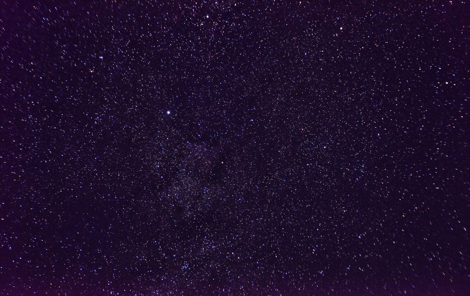
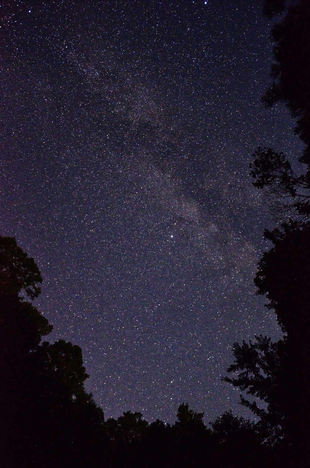
Venus and Mars
Lots of stars, but lots of airplanes, so no really good photos
That night a thunderstorm blew through, thankfully not as bad a the one at Laurel River Lake. I woke up to a very windy and overcast morning.
Lots of wind today, thankfully at my back, would have been impossible/dangerous if I had to paddle into the wind. Without paddling, I was being pushed at ~4 MPH. It was fun cruising along with so little effort. But I had the George Castanza line in my head "
The sea was angry that day"
I stopped at Cable Cove to check out the Cable Cemetery. It made a good lunch spot and I was able to play with some long exposures and the clouds.
The trail to the cemetery parallels the creek for a little bit
And then follows what I suspect was a road 100 years ago.
Old home site at the end of the road
I was hoping for more wildflowers, but I was probably a couple weeks too early
Are Daffodils "wild flowers" if they were planted 100 years ago?
View of Cable Cove
A couple gravestones at the Cable Cemetary
Every time I visit a smokies cemetery, I am always struck by how many children died at such young ages. I can't imagine being this family.
I then paddled on towards Hazel Creek and the site of Proctor. The lake was down too low for me to walk up the trail at Hazel Creek, so I had to backtrack and hike up the Ollie Cove Trail. It was a good day for a hike, but I had about a mile to carry all my gear. A little heavy since I had packed for a paddling trip vs. a hiking trip.
The campsite is large with a number of firerings, I found one that had no garbage and a lot of wood that someone had spent a lot of time processing. Someone really wanted me to have a fire that night.
Since it was only about 3, I went exploring for a bit. The Calhoun House was built in the 1920s. I passed through this area 3 times now, and every time I have to take a picture of the house.
There were lots of daffodils in the area. Kind of neat to think that they have been growing there for 100 years.
Some true wildflowers (I think wild geraniums)
I then continued down to the end of Hazel Creek.
Remnants of an old bridge. Based on the water line, I think this might have been the old railroad bridge from the logging days. In the background is what looks like a bridge/road bed, that might have once crossed the trestles, but spring floods have washed it away.
I thought this rock was interesting with the very obvious seam of quartz in the middle.
There is lots of remaining junk that is old enough to be archaeological, like this old steel beam
Sign at the bridge across Hazel Creek.
I had a quiet night with my campfire and then woke up to an overcast day.
My goal today was Bone Valley about 7 miles north into the middle of the park. The
last time I was in the area I had tried to check it out, but the creeks were too high.
The Hazel Creek Trail follows the old railroad bed, so it is very easy hiking. Just north of Proctor is the remains of the old log mill.
One of the 5 creek crossings on the way to Bone Valley, the water was very cold and at a couple of the crossings was up to mid-thigh. I just pulled my pants up high and waded through.
The Hall Cabin at the end of the trail (according to the sign, it was built around 1880).
I had imagined that I would hang out on the porch, enjoy lunch and relax. But, my feet were soaked, the temperature was about 40 and there was a forecast of rain starting around 4. So I explored a bit, ate a quick lunch and watched snow flurries.
I made a quick visit to the cemetery. I like the daffodils better than the plastic flowers.
There are some ruins of an old lodge right next to the cabin, but all that is left is the chimney and foundation.
It really started to snow as I was in the middle of the 3rd creek crossing, only 2 more to go. By the time I got back to the Hazel Creek Trail, the snow was really coming down and was sticking to the ground.
Snow on a spiderweb.
It stopped snowing after about 1/2 hour, but did not warm up. In the end, better to be snowed on vs. rained on given the temps.
Old axle in a tree.
I ran into a dad and 2 adult sons fly-fishing, they were staying overnight. Saw them briefly the next morning. I had enough firewood left for another fire and the rain/snow held off until about 7:30. I woke in the morning to this
I quickly ate breakfast and went to find some snow pictures. The snow was already melting off the tree tops.
I walked back down to the end of Hazel Creek. The cracked mud and snow was really cool.
And then it was time to pack up and get back on the water.
It was a gorgeous day with very little wind. But the previous couple of paddling days and found muscles that don't usually get used. Clearly I need to use my rowing machine more if I am going to enjoy paddling.
A great way to end the trip.
In the end, I hiked about 20 miles and paddled about 15 miles. A great couple of days.