Showing posts with label cemetary. Show all posts

Wednesday, September 12, 2018

Dad and Daughter go paddling

9/1 - 9/3/18 (2 nights)
2018 bag nights: 32
Trailhead: Cable Cove boat ramp (Nantahala NF)

The kids started school in the middle of August and I started teaching at the end of the month. And soccer started which means I am now coaching 3 different teams, backpacking takes a backseat until November. But Labor Day weekend means no school on Monday and no soccer games on Sat or Sun. So, let's do one last trip to wrap up summer. I've been wanting to do another kayaking trip on Fontana Lake and I also wanted to take my oldest (9.5 years old) on a trip by herself.

A little bit of rain as we got close to the lake, but not too bad. We got to the boat ramp and got set up and launched at about 3pm with lots of clouds in the sky. About 5 minutes of paddling and the sky opened up on us with lots of wind/rain and some thunder. Thankfully the wind/rain was at our backs and after about 20 minutes of paddling we were out of the rain and not hearing thunder, but there was a stretch where I was questioning my judgement and wondering if we should head back to the ramp.


Looks good in front...

... not so much behind us

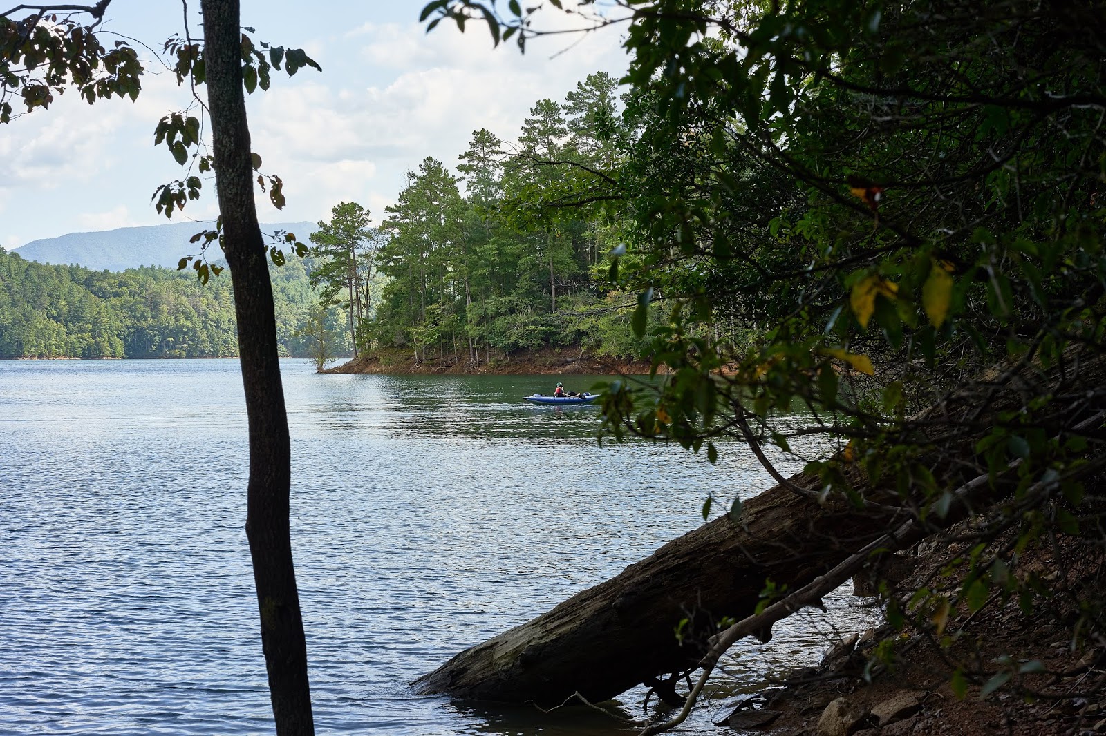
All smooth paddling now

Another hour or so of paddling and we had reached Site 81 in the GSMNP which was going to be home for the next two nights. Unfortunately, there was a boat already there and they (two men and two young boys) had taken the site closest to the water. We did not have much stuff and it is a short walk to the next site, so it wasn't a big deal, it just made it more difficult to easily enjoy the water view.

We setup camp and relaxed a bit and then my daughter mentioned that she wanted to play on the bear cables. In the past, she has has put her foot in the loop and I pull her up a little bit. I mentioned that she was getting too big/heavy for me to do this and we probably would not do it on our next trip. She then decided to try to pull herself up, I said go ahead but I did not think she was strong enough. The next thing I know, she somehow falls, lands flat on her back and knocks the wind out of herself. She landed hard enough that she was hyper-ventilating a bit and her lips started to turn purple. Scared me to death, but I got her breathing deeply and she laid in the tent for a bit and recovered. After a bit, she said she felt a little stiff and wanted to walk around a bit, so we wandered back to see the other people near by.

It turned out that they had taken the boat for a sunset cruise so there was no one to talk to. There campfire was still smoldering so I gathered a little wood and we borrowed their fire ring for a little bit. When they got back after dark, they were happy to see a fire already waiting for them.and we ended up sharing their campfire and talking for a bit before turning in.

The next morning I slept in a bit and then got up to read and leave her sleeping. She ended up sleeping until 9am. After a bit, we got back on the water. I had the idea of paddling a bit and then hiking to check out a couple of the old cemeteries. So, we paddled for about an hour and a half over to where Pilkey Creek drains into the lake. I had passed this way in March on the Lakeshore Trail, so I knew there was a road/path from the lake. We swam in the lake to cool off and then had lunch and then hiked about a mile up to Pilkey and Posey Cemeteries.


We talked a little bit about the history of the area and I told her what I had read about Decoration Days and then she spent a little time neatening things up a bit.

Pilkey Cemetery has about 30 grave sites, a lot are infants or young children, but one was a woman who lived to be 103 years old!

Posey Cemetery has 5 (or 6) grave sites, 4 kids (all born in the very early 1900s) and 1 adult (William Posey). There is another gravestone in the back that was also William Posey, but with a different birthdate, but same year of death. Somewhat odd, but William Posey died before any of the 4 kids were born and there are no other graves.

After relaxing in the shade for a bit, we headed back to the shore, where I jumped in again to cool off. Then we paddled back to camp and then she paddled the kayak by herself for a little bit while I read on the shore and took a couple photos with my camera.


The other boat came back and she helped the younger boy try to find worms for fishing, that occupied them for about a half hour and then he got a hot dog from his dad, still did not catch anything, but the two of them seemed happy. Then dinner and we again visited the neighbors and their campfire.

The next morning we took our time packing up but were on the water by 10, about an hour and a half later we were at the boat ramp. Not far out of the way was Tapaco Lodge, I had seen their sign mention pizza on previous trips, but had never stopped. This seemed like the perfect time to check it out. On a previous trip we had decided that we were going to celebrate  our backpacking trip with a "celebration pizza" and she wanted pepperoni and olives. So one "celebration pizza" and then a very long drive home with lots of holiday traffic and idiotic drivers.

When I asked her what she liked best, she said the cemeteries and the paddling. It was a great way to spend a long weekend. And a great way to end summer.

Tuesday, August 28, 2018

Next time a machete

Joyce Kilmer/Slickrock Wilderness (NC)
6/25 - 6/27/18 (2 nights)
2018 bag nights: 12
Cheoah Dam Trailhead
mix of cell phone and real camera photos

I had a couple nights to myself to recover from Sweden and I realized that I had not been back to the Joyce Kilmer/Slickrock Wilderness in a while. I decided to start at the bottom and climb the Slickrock Trail to Naked Ground and then over to the Bob Bald and then maybe check out the Foderstacks to complete the circle. As usual with this wilderness area, things did not go according to plans.

I got to the trailhead and it was looking to be hot and humid, no real surprise for the end of June. I knew that the Slickrock Trail had lots of creek fords, so I hoped the humidity would not be too bad. It was bad :) By the time I had hiked about a mile, I was soaked with sweat. I got to the creek and stripped down and jumped in. The water was on the cold side, but felt good.

I slowly made my way up the creek/trail and got more soaked when the sky opened up, but eventually I got to a good campsite near the intersection with the Stiffknee Trail. It wasn't as far as I had expected to go, but it was a good stopping point and I was a little frustrated with how overgrown parts of the trail were. Basically, I was ready for a break and a little bourbon pick-me-up :)

Along the way, I passed a couple nice trickles ...

... and drops in Slickrock Creek that made me get out the tripod.

Someone must have really liked Jere Lee to put the effort into this sign :)

I quickly setup camp since it looked like the rain might come back ...

... and then enjoyed the view and sounds of Slickrock Creek ...

... and the Rhododendron flowers.


The next day I got moving up the trail still with the idea that I would take the direct route to Naked Ground via the "Nutbuster".

I took my time and stopped for an early lunch at Wildcat Falls.


And then a little later I ran into 3 guys camping who mentioned that Tipi Walter had mentioned the trail being covered with blowdowns and a couple rattlesnakes. Given that info and my frustration with the trail the day before, I decided to take the long way to the bald and go through Big Fat Gap.

Along the way I ran into a trail crew doing trail work and Tipi Walter. He showed me photos of the snakes which made me glad to avoid the Nutbuster.

I got lucky and caught the end of the Flame Azaleas blooming ...

... saw some great views ...


... and made my way to the Bald. I was a little hopeful for some stars mixed with clouds given what the sky looked like when I first was setting up camp ...


... but the weather changed very quickly. I was in a pretty exposed area and the wind really picked up, so I actually broke camp in the pouring rain and moved to a more sheltered area. 

The next morning, things looked a little better, or at least a little drier. I was still pretty damp from sweat and humidity and rain, but was hopeful that things would dry out a little bit...

... and then I got back on the trail and was promptly soaked by all the wet leaves. At this point, I checked the weather on my InReach and thought a little bit about bushwacking in the rain and decided that I would rather head for the car and sleep in a dry bed.

As I hiked, the sky made me think that I had made a reasonable decision.

So I retraced my steps back to Big Fat Gap and then took the Windy Gap Trail to Nichols Cove Trail to Yellowhammer Gap Trail to Ike Branch Trail and back to my car. In those roughly 5 miles I got to do more bushwacking and got completely soaked by a couple inches of rain.

At one of the trail intersections is this little grave site. The inscription basically reads "Two sisters born Dec 14 1914, died Dec 20 1914" yet another reminder of how hard life was in these parts a hundred years ago.


I stopped at the pullover on the Tail of the Dragon for a photo op, this is looking down on Calderwood Dam on the Little Tennessee River.

So the title of this post, after all of what felt like bushwacking I decided that some of the trails needed to be brushed back quite a bit. The trail crew was working on the Benton Mackaye Trail, but were not going to hit the side trails that also needed a lot of work. So I went on Amazon and found a sort of light weight machete and I plan on going back in the fall and seeing what I can do to help maintain some of the trails.

Wednesday, March 28, 2018

Forney and Hazel Creeks (GSMNP)

Great Smoky Mountains NP
Trailhead: Tunnel at the end of Road to Nowhere

3/12 - 3/16/18 (4 nights)
2018 bag nights: 5

Day 1 miles: 6.5
Day 2 miles: 10.75
Day 3 miles: 11.25
Day 4 miles: 18
Day 5 miles: 3
Total miles: 50 miles
Campsites: 70, 82, 81, 74

My planned trip was to start at the Tunnel at the end of the "Road to Nowhere" outside of Bryson City. Then Lakeshore Trail to White Branch Trail to Forney Creek Trail and site 70 for the first night. The 2nd day was Jonas Creek Trail to Welch Ridge Trail to Hazel Creek Trail and site 82 for the 2nd night. Day 3 was Hazel Creek Trail to Lakeshore Trail and site 81 for night 3. Day 4 was Lakeshore trail to site 98 and then day 5 Lakeshore trail to my car.


So I wake up Monday morning and I find that school is cancelled because of snow and I look out my window to this.


I spent about 45 minutes shoveling 6 inches of wet heavy snow so I could get the car out of the driveway. And then I was off to North Carolina.

Driving down I got a little nervous because it was still snowing near Knoxville and it was very windy, did not look like a great day for hiking. I was especially worried that the snow would turn to rain. Thankfully, by the time I got to Bryson City, the snow had stopped and the sky was clearing up.

The tunnel at the end of the "Road to Nowhere"

The Whiteoak Branch and the Forney Creek trails are next to the respective creeks which means lots of cascading water. I love hiking with the sounds of a creek next to me.

Bridge across Forney Creek at site 70. This was a great place to sit after dinner and watch the sky get dark. The bourbon was nice as well.

The first day was easy even with a full pack, 6ish mostly flat miles (or at least flat for the Smokies). The second day was going to be a lot harder. I knew that the Hazel Creek trail was going to involve a lot of creek crossings, but I thought that the first part of the day would be dry feet and a climb up and over Welch Ridge. It turns out that the Jonas Creek Trail has 5 or 6 crossings, the first about 15 minutes after leaving camp. I had my trail runners, so I just wade through, unlike the older couple I caught up to who were taking off their boots for every crossing. So, I had cold wet feet/shoes all day long instead of just in the afternoon.

The Jonas Creek trail is great, with all the wet feet, it is probably better in the summer, but it was very pretty in the early spring. The water was very cold though.

Got up to Welch Ridge and there was still a bit of snow on the ground which made my wet feet even colder. In places the snow was 3-4 inches deep.

And then down the Hazel Creek trail and out of the snow. The Hazel Creek trail has a lot of creek crossings, but I had been here before so wasn't surprised. This is one of about 20 crossings over 4ish miles, most of them are no more than knee deep, so not hard, just cold and just as your feet start to dry out and warm up, there is another crossing.

In other parts of the trail, the creek just flows down the trail. At least it was not muddy.

Got to site 82 about 4pm and got water and firewood and just relaxed, crawled into my hammock to read a bit and slept through the night. I woke up to this and the snow was still coming down. Since I wasn't in a huge hurry, I used my hiking poles to prop up the tarp and had a leisurely breakfast and watched the snow. When it became apparent that the snow was stopping, I packed up and headed down the trail.

The lower part of the Hazel Creek Trail is an old railroad bed, so it is very easy walking with a slight decline going towards the old town of Proctor. Nice walking and the snow stopped after about an hour. The day never warmed up though and I had my fleece on the whole day.

Hazel Creek starts to build up steam as it drops lower in the valley and more side streams combine.

Glad the crossings in this part have bridges.

Lower Hazel Creek

The only "hard" part of the day was the climb over Welch Ridge on the Lakeshore Trail, not really hard, but not easy like the Hazel Creek Trail.

I detoured to check out Fairview Cemetery which is not far off the trail. While there I heard a loud plane and looked up to see a C-130 flying low over the Fontana Lake, low like below the ridge line, I couldn't move quick enough to get a photo though. Kind of cool and confirms what I thought I heard in the middle of the night on a past trip in the area.

I got to site 81 which has easy access to Fontana Lake. I had deliberately planned the trip because the last couple nights were supposed to be clear and moonless and I wanted to see stars.

You can see how low the lake is this time of year. In a couple months, all of this will be under water.

I was disappointed by the amount of skyglow. I think that the lake must reflect a lot of light. It was cold enough that I did not spend a lot of time with my camera, but the stars were very pretty.

You can just make out Orion behind the trees on the right and the bright star near the middle is Sirius.

The next day I was hoping to check out some of the old cemeteries along the Lakeshore Trail. At one point, there was an obvious side trail and this tree. I suspect that someone bent this tree to mark the trail to the cemetery.

A couple minutes from the tree was two graves. One was marked "Infant Cook" and the other "Helen Cook, daughter of HB and Mac Cook". All of the cemeteries in this area are filled with young children which makes the father in me sad.

Just off the trail is the remains of an old car. That is the rear of the car and you can see where the spare tire would have been mounted, the bolts are still there. 

Old stone wall and the remains of a chimney

I got to site 98 about 4:00 and the wind was blowing right up the lake with gusts in the 30-40 MPH range. I decided that this did not look like a nice place to relax and looking at the map realized that I was about 7 miles from site 74 at Forney Creek. I had been there before and knew that I could get to the lake shore easily to see stars. And if I hiked the 7 miles today, I would have an easy 3 mile day back to my car. So, let's see if we can still do an 18 mile day.

The last hour was hard and I was regretting my decision, but I eventually reached site 74. No one was there which sort of surprised me. I set up camp and walked out to check out the lake and then had dinner. As I was finishing up, a solo hiker appeared. He mentioned a fire, I said I was planning on being lazy, but I would gather wood for a fire while he set up camp. We chatted a bit, but I was tired from my day and turned in early to read a little bit.

I woke up to a beautiful day and headed back to the lake after breakfast.

Forney Creek flowing towards the lake. The sun was just rising above the ridge on the left.

Cool looking rock in Forney Creek. All the other are brownish and then this glowing white one.

Sunburst over Forney Creek.

After photo time, I said goodbye to the other guy and packed up and had an easy hike to the car. I was glad that it was only 3 miles because my feet were a little sore from the previous couple of days. I got back to my car after an hour and regretted that I had forgotten to bring a change of clothes. All in all, a great trip, I got a physical/mental challenge on day 2 with creeks and snow, another challenge on day 4 with 18 miles, and mostly great weather and only a couple of other people.