Yahoo Falls Trailhead
Sheltowee Trace => Kentucky Trail
2 nights ~38 miles
2016 bag nights: 3
A little while back, I became intrigued by the Kentucky Trail in Big South Fork. It is a roughly 20 miles trail with only a couple of access points and based on previous experience in BSF, I figured there would not be a lot of people. I planned on heading south from Yahoo Falls on the Sheltowee Trace and then doing a loop that connected the Trace with the KY Trail. I estimated that I could do this in a 2-night trip given the long days this time of year. I did not do a lot of planning before heading out, because I have been thinking about this loop for about a year. It turns out that I should have done a little more planning :)
I parked at the Yahoo Falls Trailhead and went to check out Yahoo Falls (the highest in KY at 113 feet). There had been a lot of rain recently and the falls were really going. I poked around a little bit and then headed south on the Sheltowee Trace.
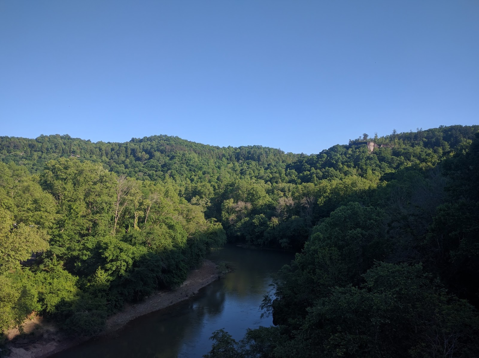
View of the Big South Fork from the overlook near Yahoo Falls

Rock wall along the trail


Unknown waterfall along Sheltowee Trace, all of the little falls were flowing, lots to look at


Local wildlife. I spooked a wild turkey and while I was trying to get my phone out and get close enough to take a picture, I saw a black snake slither off into the bushes. No picture of either one of those.
Milipede


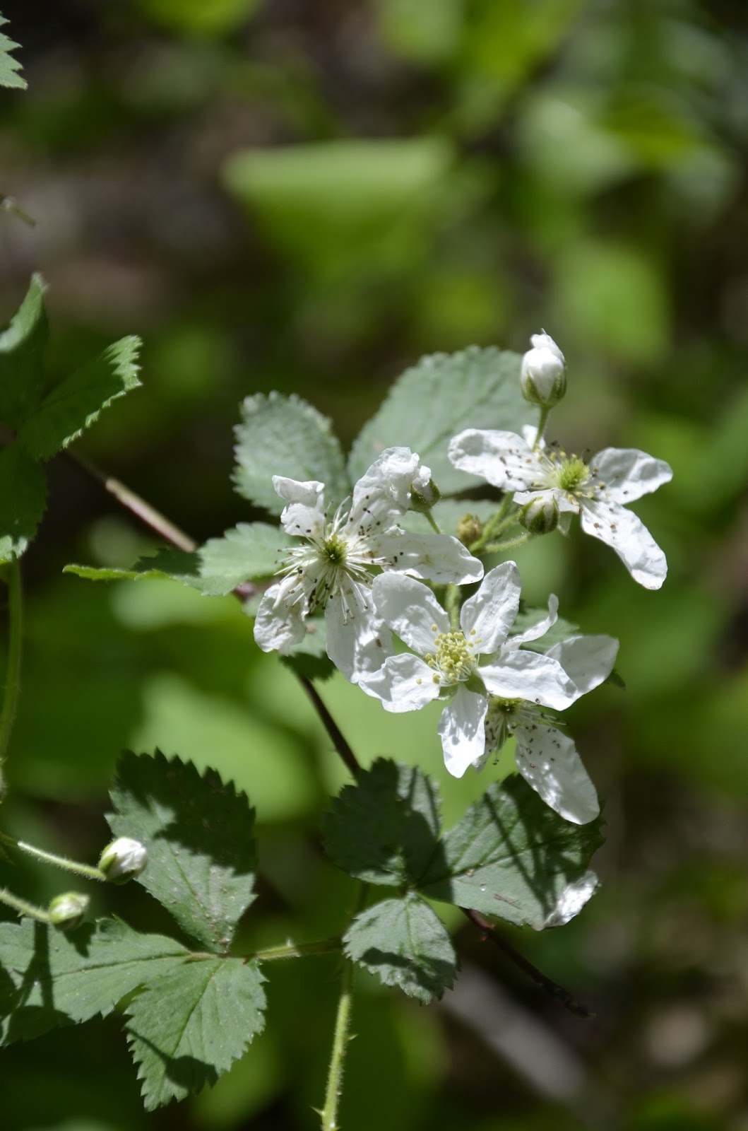
No idea what tree this was, but it had interesting/pretty flowers (thanks to copper_creek on kywilderness this is a sweetshrub or Calycanthus)

Up the trail towards Princess Falls


I did not go up the creek, but it looks like it would be fun to wade in

Unnamed falls just off the trail.

Bridge at Yamacraw

View from the bridge

The Sheltowee Trace is very muddy and overgrown between Yamacraw and Rock Creek and you still hear every truck that drives by on the road just up the hill. I decided that a road walk would be more pleasant than this section of the Trace. I would come to regret that decision the next day.


The Sheltowee Trace intersects with the KY Trail not far past Rock Creek. At one point, it goes under powerlines that had been mowed recently.


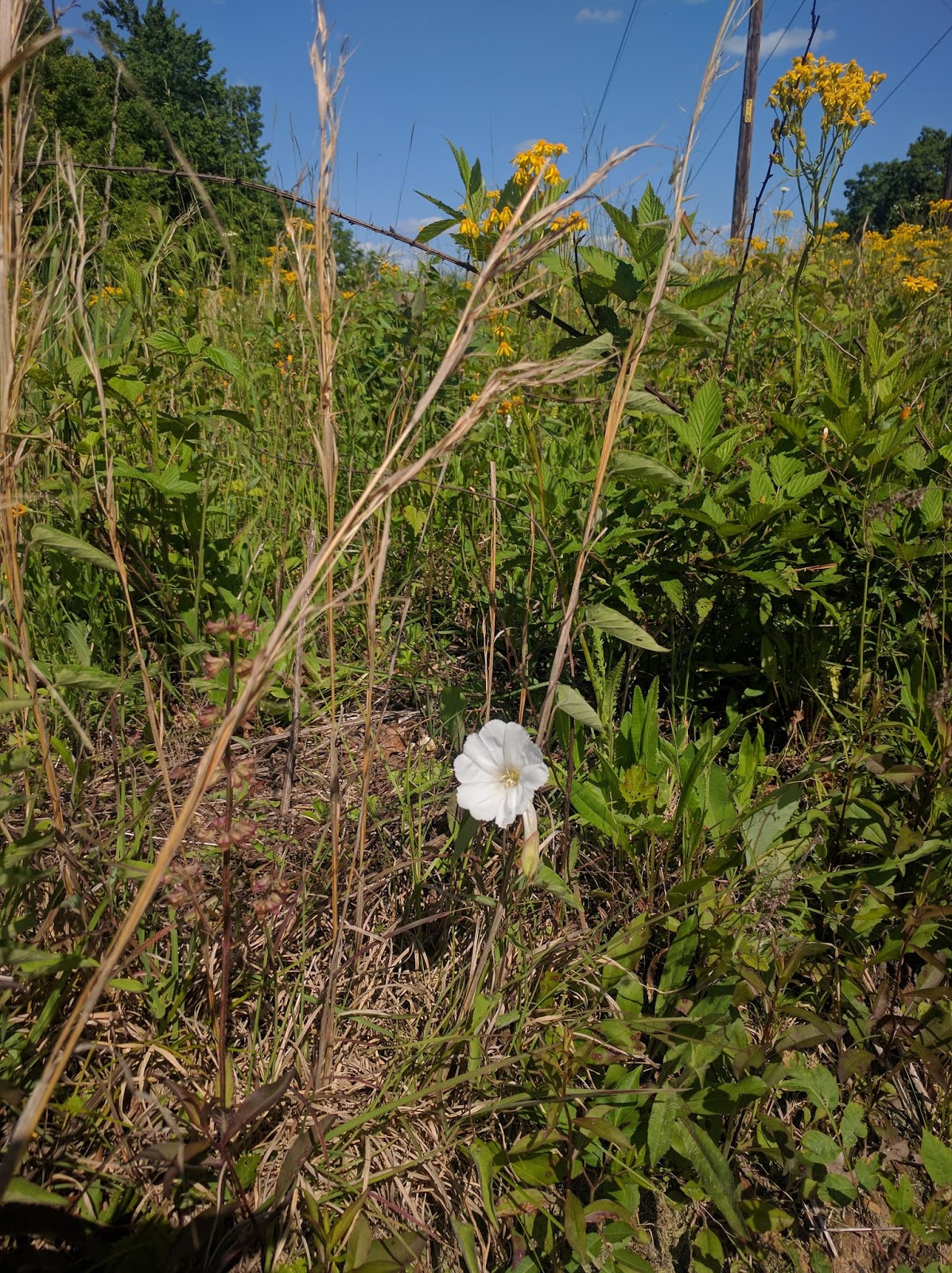
There was one random white flower mixed in with all of the yellow, makes me think of a petunia. I think it might be a "hedge bindweed"
There is a short road walk (~1 mile) before the KY trail drops back into the BSF. It was actually pretty nice, lots of shade and no traffic since the road dead ends near the powerlines.

Weeds, I mean flowers, growing along the road.


As the trail approaches Blue Heron there are remains of the mining operation.


A random flower (the flash on my phone went off which is why the light looks a little weird)

The bridge to Blue Heron. I thought about setting up camp nearby so I could watch the stars come out from the bridge, but I decided to make the climb towards Catawba Overlook.

View from the bridge

I made it up to Catawba Overlook in time to enjoy the view and the sunset. While waiting for the sunset, I set up my hammock nearby.


I watched the stars come out, but by the time the sky got really dark, I was ready for bed.
Woke the next morning a little before 7, not much of a view.

But once the sun crested the ridge, the fog disappeared in about 5 minutes.

Dick Gap Falls

A nice morning hike.

More flowers


One last look from Catawba Overlook.

The bridge to Blue Heron again

I had lunch at the canoe launch at Blue Heron and soaked my feet.

Then headed up the Blue Heron loop to see Devil's Jump. The river gets really narrow here and makes for some pretty big rapids. It would be fun to sit and watch the kayakers go through here.


View from the K&T Bridge

Road walk to Yamacraw, in ~1.5 miles about 10 cars passed me, better than the Trace.

I was hoping the little grocery store at the Yamacraw bridge was open (really I was assuming it was open and I was hoping for a beer) alas, it was not to be. So, I continued north. At this point, I was thinking of getting back to my car and driving home, but it was a little too far. I could have done the distance, but I would have got to the car around 8 and then had a 2 hour drive. Instead, I set up camp at the intersection of the Trace and Negro Creek Trail.


Another solo hiker with two Britanny Spaniels came along about an hour later and set up camp nearby. Then a couple guys on horses came by. They had ridden down from the ridge to set a couple fishing lines. Talked to them briefly and then said
"Do y'all have beers in those saddle bags?"
Guy 1 says "We wouldn't be here without them" I must have looked disappointed because Guy 2 says
"Do you want one?" You can imagine my response :)
Best Busch Light I have ever had. While Guy 2 was setting his lines, I talked to Guy 1 and when he got another beer for himself, he gave me another. Best Busch beer I have ever had :)
They headed off after a bit and I cooked dinner and watched the sun drop below the ridge across the river and then headed to bed to read a bit.

Woke the next morning and enjoyed the view while eating breakfast.


One of the dogs.

Along the way, the trail passes Yahoo Arch

Once again, not the trip I had planned, but still a very good time. Blue Heron looks like it will be a fun place to visit with the kids. I'll wait for the fall and do the KY Trail/Sheltowee Trace loop starting from Blue Heron.