Wednesday, August 17, 2016

She Did It

Bob Stratton Bald
8/3 - 8/4/16
2016 bag nights: 17

Beech Gap trailhead (off the Cherohala Skyway)

I have been trying to get my wife to give backpacking a try for a couple years. She has been car camping, but the lack of "facilities" was an issue for backpacking. As our kids have got older and gone backpacking with me, the fear of being left behind began to dominate the lack of facilities. Then, it was just a matter of lining up childcare so we could go off into the woods for a couple of days without any kid distractions.

I wanted to go somewhere with a nice payoff and something that would be difficult to do on a dayhike. I decided that a trip to Joyce Kilmer-Slickrock would work, specifically a couple nights on Bob Stratton Bald. Hopefully, we would get killer sunsets, lots of stars, and a little bit of dayhiking to finish it off.

My mother was in town to see the kids and the weather looked reasonable for the Southern Appalachians this time of year, so we left for a two night trip to Joyce Kilmer-Slickrock Wilderness. We had a short hike in from Beech Gap on the TN/NC state line (roughly 3.5 miles), so we each carried a beer for happy hour and she had a couple cans of wine while I had some bourbon.

It was an easy start to the day. The thermometer in my car read 75 and there were some dark clouds, but it did not look like it was going to rain.

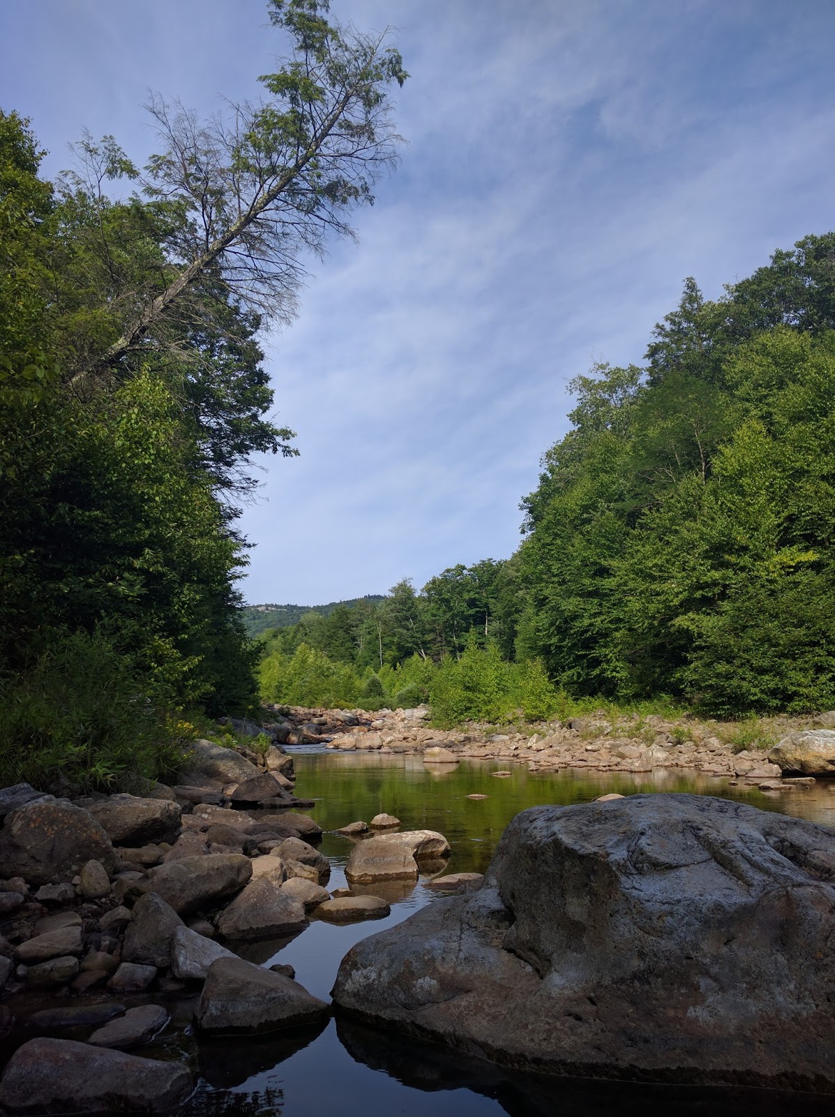
The trail is an old forest road for the first 1 - 2 miles and was lined with wildflowers.


A hint of wildlife :)


And then a tiny snake in the middle of the trail.


The bald looked very different from the last time I was here (March).


The trees had leaves, all of the blackberry brambles had filled in and the grasses were knee to waist high, but we found a great campsite and enjoyed our happy hour beers surrounded by wildflowers, with a view of the mountains to the south.


There was not a great sunset view because the sun was dropping behind the trees, but the clouds to the east were very pretty.


I started a fire on the early side because we were going to have "pizza rolls" based on a recipe in the new Backpacker magazine. I don't know why I trusted the recipe, since I don't trust Backpacker for anything else. This recipe proved to be a bit of a problem. I think it would have worked with a huge bed of coals, but we would have had to gathered three times the amount of wood and burned it all before we started cooking dinner. A small fire and a bit of coals, meant that dinner took about 1.5 hours and it was almost 9 when we finished eating. I dumped the rest of the wood on the fire as we ate and we enjoyed the fire while the stars came out.


There was some lightning on the horizon that was lighting up the clouds, it made for an interesting view. Unfortunately, all of my photos that captured the lightning also captured passing planes.


We woke up in the morning to a ton of dew, it made for nice pictures, but my feet were very wet. It turned out that my feet/shoes were about to get a lot wetter.


And then we headed off towards Naked Ground and the Hangover. The trail was very overgrown (completely different from March) and the grass and plants were covered in dew. My wife referred to it as "the carwash"


We enjoyed the view at Naked Ground for a bit ... 


...before moving on to the Hangover. Unfortunately, the clouds had moved in and there was not much of a view. It also turned out that the lens on my cell phone camera was smudged, so this picture looks way worse than reality.


After about 30 minutes, we headed back to Naked Ground. We sat under the trees and avoided most of the drizzle that had begun.


The drizzle did not last long and did not really matter since the carwash had us pretty wet already. We got back to camp and I spent some time chasing the butterflies around...


... and then had an early dinner before the rain came again (a lot harder this time). Thankfully, it did not last long and we crawled out of the tent to see a sky with lots of dark clouds. About this time the thunder started up and my wife spent some time inspecting the clouds trying to figure out if we were about to get hit by lightning.


While she was thinking, I tried to capture a rainbow.


We had not seen any lightning and I thought that the thunder was moving away from us, but my wife had visions of dying in the middle of the night. It was about 7pm so there was about 2 hours of daylight left (enough to get to the car without too much trouble). I told her that she should decide if she wanted to stay or go and I would do whatever made her happy. About that point, there was a loud crack of thunder that seemed to be a sign. So we packed up and headed down the trail.


In less than 2 hours we were at the trailhead.


We found a hotel since it was too late to think about driving home. It is hard to say what would have happened on the bald, but there was rain (and lightning in the distance) on the drive down to Tellico Plains and then it poured at the hotel by I-75 all through the night. I suspect we made the right decision and hopefully my wife will join me again.

Sunday, August 7, 2016

Dolly Sods Circumnavigation

Dolly Sods 7/24 - 7/27
Red Creek Trailhead
2016 bag nights: 16

**********
The "heat dome" was coming to KY and my wife and kids were heading to her parents, so I decided I could either go to North Carolina mountains or West Virginia mountains. After a moment of thought, I decided this would be the perfect time to revist the Dolly Sods. Even better, the weather forecast looked like the highs should be about 80 with very little chance of rain.

Soundtrack: the chorus to Sam Cooke's Cupid running on repeat in my head for most of the trip, heard on Pandora on the drive to WV. Weird hiking music, but happy

"Cupid draw back your bow
And let your arrow go
Straight to my lover's heart for me, only for me"
**********

When I got to the trailhead about 4pm, the thermometer in my car said 88! I headed up the Red Creek Trail and then crossed the creek onto the Big Stone Coal Trail.


My goal was the Lion's Head since I had never been there and the sky looked like the stars were going to be out. Big Stone Coal was a nice hike with nice flowers.


From the map, it looked like I could load up on water near the intersection with the Rocky Point Trail and then head up to the Lion's Head. I hiked about 10 minutes past the intersection and came to a largish waterfall that was easy to climb down to from the trail.


I spent a little time enjoying the view and then headed up the trail to find my way up the slope of Breathed Mountain. In the process I spooked a deer.


I had one false start where I saw a cairn and what looked like a trail, but wasn't and then found a very obvious trail and lots of cairns marking the user trail to the Lion's Head.

The path through the pine forest was very pretty in the fading light


I followed cairns out to the Lion's Head hoping that there would be a place to hang my hammock, but no such luck. So I explored a little bit and enjoyed the view...


... and then headed back to the pine forest to set up camp.


As it got dark, I heard something moving around in the brush. When I shined my headlamp that way, there were a couple of deer. I ended up seeing at least 5 different deer that evening and a couple woke my up in the middle of the night. I kept throwing rocks at them hoping to scare them away, but they were very unconcerned by more poor aim through the trees.

There was a little clearing near by where I watched the stars come out and I tried a little bit of astro-photography. I'm pretty pleased for first attempts.

That is Mars at the bottom.

This is looking towards the east and more towards the Milky Way (I think the bright star is Altair.)

In the morning, I headed back out to the Lion's Head to see the sunrise...


... and then had breakfast and decided what I was going to do for the day. I had deliberately planned only the first night's campsite and then was going to play it by ear. The weather looked like it was going to be nice, so I decided to head up the Big Stone Coal Trail to the Rocky Ridge Trail so I could enjoy the views into Canaan Valley.

I enjoyed the waterfall again and had a chance to play with shutter speeds since I had brought my Gorilla Pod.


The upper part of Big Stone Coal is pretty flat and is an interesting mix of forest and open areas. The trail parallels the creek, so I filled up with water since I knew that the Rocky Ridge Trail was dry.


I had lunch overlooking Canaan Valley and got a cell signal to call my wife. While I was talking to her, a military jet (I think a F-15) flew right up the valley at an altitude that was lower than where I was sitting. It was pretty cool to see, but I could not get my camera out quick enough to get a picture.

As I moved up the Rocky Ridge Trail I began to regret my decision, the sun was beating down and it was hot again (upper 80s) and there was not a lot of breeze. In retrospect, I should have headed down the Dobbin Grade Trail and filled up with more water, but instead, I kept heading north away from water. By the time I got the the Raven Ridge Trail at the NW part of the sods, I was almost out of water. I decided to aim for the Bear Rocks Trail where it crosses the upper part of Red Creek. It was a pretty hike, but really hot and I was having a hard time enjoying myself. I did eat a number of wild blueberries and that helped keep me going.


I got to Red Creek and filled up on water. At this point, it was about 3pm and I had a decision to make. I could hike on and see some more of the area or I could just call it a day and enjoy the creek and the shade. I decided to relax and read my book.


The next day I got up and decided to slackpack over to see Bear Rocks. The short road walk was lined with flowers, these were the most unusual/pretty (I think it might be a "Wood Lily").


The rocks were a lot of fun to climb on and the view was pretty good.


Then back to camp for lunch. I packed up and then decided to head south on the Raven Ridge Trail towards the Forks of Red Creek. It was a lot more cloudy today and cooler, a more enjoyable day to hike.


Got to the forks area and there was one couple arriving about the same time. I was happy to see that there was not a lot of people since the last time I was here, there were probably 10 different groups for a total of 50ish people.


This is probably the best view I have had from my hammock

I stripped down and sat in the creek for a bit and then wandered around taking pictures and hoping that the clouds would break so I could see stars again.


But, it ended up sprinkling a little bit and the clouds never went away. I read my book for a bit and then laid in the hammock watching the fireflies before falling asleep.

Woke up to clearer skies and had a decision to make. I was still feeling pretty beat from the dehydration two days ago and the battery in my SLR had died. My phone battery was really low. I had been thinking of checking out the Roaring Plains area for the last two nights, but I decided that it would be better to save it for another day.


I decided I would take the Red Creek Trail to the Fisher Spring Trail and then head south on the Rohrbaugh Trail to the forest road and then road walk the three miles back to my car. This also left open the possibility of checking out the Roaring Plains if I was feeling good at that point.


The Rohrbaugh trail is an old railroad bed, not the best walking surface, but this did not last long.


Because I had not done much research for this trip, I was surprised to come across an awesome overlook with views up and down Red Creek. I could see where I hiked the first day and then this morning as well. It made a great lunch stop.


The rocks in the middle of the picture are the Lion's Head.


I got to the road about 2 and decided that I would rather be done versus another night, so I headed down the road to my car. The road is lightly traveled and was all downhill, so it was an easy way to finish off the trip.

The road was lined with wildflowers


I got back to the car and cracked a beer and then walked up the trail to Red Creek for a "bath" and then headed to Davis, WV for a burrito and a beer at Hellbender Burritos. Then all that remained was a 5.5 hour drive back home.

A great trip, but I really wish the weather report had been accurate. A couple of days in the high 80's drained the gas tank and made the hiking a lot harder than expected.