Tuesday, October 20, 2015

Dad and daughter go backpacking

Great Smoky Mountains National Park
9/5 - 9/7/15 (Labor Day weekend)

I decided it was time for the oldest kid (6.5 years) to do a "bigger" backpacking trip. The previous summers we had done a short overnight trip at the Red River Gorge, but never walked more than a mile from the trailhead. This time we were going to go for 2 nights and and do about 3-4 miles each day. Unfortunately, my work schedule is very limited right now so we had to go over a holiday weekend (Labor Day). I was afraid that the Smokies would be packed but as we got closer to the weekend, the weather forecast got worse. There was a high chance for afternoon thunderstorms all weekend and I think that scared some people away. I crossed my fingers and hoped that it would not rain too much and we headed out on Saturday morning.

The plan was to park at the end of the "Road to Nowhere" outside of Bryson City and then hike the Lakeshore Trail to campsite 74 on Forney Creek. JC and I had passed through this site a couple years ago when I hiked the whole Lakeshore Trail and we both remarked that it would be a great place to bring kids. Then the 2nd day, we would hike back towards the car and then head down the Goldmine Loop Trail to campsite 67. Then finish off the Loop Trail back to the trailhead on the 3rd day.

After a long drive, we got to Bryson City as the sky completely opened up. The drive up the Road to Nowhere was nice because the rain stopped by the time we got to the tunnel. Unfortunately, it started again before we could even get out of the car. Well, no point in getting soaked if this might blow over, so we sat in the car and I showed her how to use my new Delorme InReach if there was an emergency. The  rain stopped after about 20-30 minutes and we headed through the tunnel and down the trail.

We got to the campsite by 5:30 and hung the hammocks and filtered water. While we were doing that a couple guys came down the trail to share the site with us. It is a large flat area so we were in no danger of feeling crowded.


We enjoyed the view from the bridge over Forney Creek and the flowers.


and before it got dark we went to explore down the trail a little bit. When I passed through here the last time I was unaware of the history of the area and why there were dirt roads in some places. Just past the bridge the actual Lakeshore Trail heads up the hill and a "road" continues straight where it deadends at the lake. We played there a little bit and then headed back to cook dinner. The two guys were nice and let us share their campfire and conversation.

The next morning we walked back to check out the lake and play a little bit. Unfortunately, it was way to cold to think about a swim, but the view was very nice and the kid enjoyed playing at the beach.


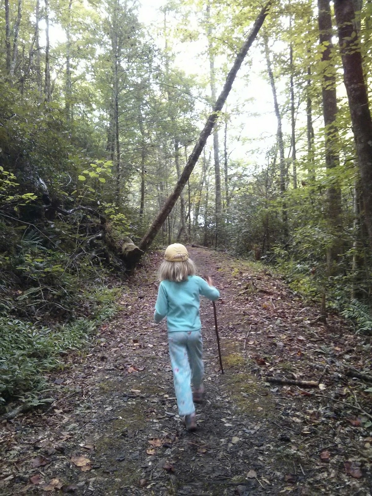
Later we moved back towards camp, but got distracted. The kid played along Forney Creek while I read a little bit and then we headed back to camp to pack up.


We headed off to the next campsite and took a detour up the "road" we had passed the day before. I was pretty sure it would end at a cemetery and after about a half mile up hill we came to a clearing and a small cemetery (Woody Cemetery). A number of the graves were new and some had flowers, but a lot of the stones were tipped over. It looked like some hogs had been rooting around. We talked a little bit about how hard life was in the area a hundred years ago. I pointed out all of the children's graves, sad how many kids did not see their first birthday. My companion did a little neatening and then we headed back down hill. 

Of course if there is a cemetery, there is a road from the lake and she wanted to see what was down the hill. I warned her that if we walked downhill, we would have to walk back up. It was about a mile down to the lake so I was glad we did not have a long way to the next campsite.

Along the Goldmine Loop Trail we passed an old homesite 


and ran into a mom and two kids (about 10 and 15). They did not have a map and were not quite sure how to get back to the trailhead. I tried to help them out, showed them my map. Hopefully they found their way but I'm pretty sure they got soaked in the rain that came not long after we got to the campsite. I was able to hang my tarp and find some wood before the rain started so we were able to have a small campfire before bed. We also walked down the trail to the lake where again much fun was had and the view was enjoyed before heading back for dinner, campfire and bedtime stories.


In case anyone is looking for hammock info, site 67 is a nice small tent site, but there are not a lot of good hammock trees. I ended up hanging across the trail that went out the back of the campsite past the bear hanging poles. You can see the trail just to the right of our hammocks.


The next morning we had breakfast and then went back to the lake to play before heading back to the car. One of us wore their pajamas on the hike to the lake since it was a little chilly.


I had noticed bear tracks at the lake the day before so while she played in the water I went looking for more tracks in the sand in the process enjoying the view of the lake. 


After a bit of play time, it was time to hit the trail for the climb to the trailhead. After a nice hike with a couple of rest breaks and a lot of discussion of what we were going to have on our "celebration" pizza (pepperoni and olives) we came to the trailhead and our car. A short drive got us to Bryson City and pizza at Anthony's Pizza (right across from the train station). I had had the pizza from there before while having beers at Nantahala Brewing and I thought it was fine. But, I won't bother going back to the actual restaurant. There is almost certainly a better place in town for a post-hike meal. 

All in all a very successful first backpacking trip. We totally lucked out with the weather. In the end the only rain that fell on us was "tree rain" also known as water dripping from the trees. We both thought that campsite 74 was great, we will definitely go back there again, next time she gets to carry some stuff.


The trip with massive dehydration

Joyce Kilmer-Slickrock Wilderness
7/23 - 7/26/15

I was feeling the need for a challenge and wanted a backpacking trip that would leave me feeling like I had "survived" something. I got my wish, but it did not work out as planned. I had permission for a 5 night trip, so my challenge would be to see as much of the Slickrock and Citco Creek Wildernesses as possible.

The night before I was to leave, we went to dinner with the neighbors. And then we went for after dinner drinks. I think I would have been fine if I had limited myself to one drink, but they tasted good and I had a second. The kids woke up at their usual 7am which meant I was on track to getting to the trailhead around noon. But, I wasn't able to finish breakfast since my stomach was bothering me. I wanted to get going so I figured I would just get something to eat on the way. It turns out a greasy sausage biscuit from the gas station Hardee's was not a good idea.

I got to the Slickrock Creek Trailhead around 2pm after initially driving right past it. The book wasn't kidding when it said it was just over the bridge. There was a forecast for rain, but it looked like it might hold off. I headed down the trail and proceeded to get pretty wet from the rainwater already on the bushes.


Looking down the embayment where Slickrock Creek meets the lake

Looking up the creek

Those were the only pictures for the day because it started to rain soon after heading up the creek. Not to mention all of the creek crossings (felt like a couple hundred, but more like 8) made me leave my phone in its ziplock bag. Some of the creek crossings are not very well marked and in places the creek was up to my crotch. It was one of the few times I wished for hiking poles. But, I only fell in the creek once and since it was close to getting dark, I decided to make camp right there. Approximately six very wet miles were plenty for a hungover late start.

It stopped raining long enough to set up my hammock, but started to sprinkle as I was cooking dinner and continued to rain lightly most of the night. By the time I woke up, the rain had passed, but my hiking shorts and shirt were still pretty wet. The wet did not matter since there were a couple more creek crossings.


It was an easy hike up to the intersection with the Big Fat Gap trail. Nice new signs at the trail intersection of Slickrock Creek and Big Fat trail. I could smell the fresh wood. Saw more of these signs later in the day.


Up to Big Fat Gap and then south on Hangover Lead Trail toward Haoe. Stopped for a break under a big rock.


Some glimpses of a view through the trees


I passed a couple of seeps below Saddle Tree gap that I should have taken advantage of. By the time I got to the Hangover, I did not have much water left. I spent some time watching the clouds and birds while having lunch. I drank the remainder of my water and had a decision to make, one that I would come to regret.


So decision time, it was about 3:00 and I had planned on camping at Naked Ground which was only about a mile away. Since I hate sitting around, I decided I would go the long way, down the Deep Creek trail around Rock Creek Knob and then up the Haoe Lead Trail. It would add about 6 miles but I thought there was a good chance I could do it in about 3 hours since it was a little bit down hill, then follow a contour then back up to Haoe. At worst, I would make a dry camp somewhere along the trail. The guidebook said that there was water a little ways down the Deep Creek Trail and there was (~.5 miles). The first ~1.5 miles was easy downhill walking and then the trail became massively overgrown. The "trail" is straight ahead in the picture below.


At one point, there was a massive downfall across the trail and in the process of going over/around the fall, I lost the trail. It took me about 15 minutes to find it after exploring up and down the slope. I had visions of bushwacking towards the Haoe Lead trail that was about .5 miles away. I got enough water for the night near the trail intersection and then continued around Rock Creek Knob and up towards Jenkins Meadow. Finally running out of daylight I set up camp just off the trail.

Woke the next morning to a nice sunrise breaking through the clouds.


I packed up and headed up the trail. Within about 30 minutes, I was dragging and I had finished my water. Within an hour, I began to wonder if I would be able to make it to Naked Ground and more water. The approximately 2 miles and 1000 foot climb to the Hangover Lead Trail took a long time and I became more dehydrated. In retrospect, I had not had enough salt in the preceding 24 hours in addition to needing more water. I passed a couple of backpackers who had been at Naked Ground the night before and I was really regretting that I had not been there as well. Once I got to the trail intersection, I had another decision to make. I could continue to Naked Ground, get water, rest and reevaluate. Or, I could head North on Haoe Lead Trail towards Big Fat Gap and then the car. I knew that there would be water just under the Hangover since I had passed it the day before.

I decided that I was not having fun and I could make it the approximately 7.5 miles back to the car, so I headed north towards Big Fat Gap and then Yellowhammer Gap. I stopped to enjoy the view in the small clearing below the Hangover. It was neat to see the wind moving the clouds up and over the mountain sides. (I think this link will be a better quality video)


I made it to Big Fat Gap and decided to keep heading due north on the Haoe Lead towards Yellowhammer Gap. That section of trail is also very overgrown, it clearly doesn't get a lot of use.

I made it back to the car and changed into dry clothes, then headed towards home. Still feeling pretty crappy, I did not even want a beer. I stopped at McDonald's in Alcoa and added some extra salt to my cheeseburger :) and then proceeded home.

I'm not good with flowers, but I saw a couple nice lillies (I think) and some of the last Mountain Laurel during the couple days.


Once again the Joyce Kilmer-Slickrock Wilderness got the best of me. The good thing was my knee did not give me any troubles, evidently climbing 20 flights of stairs on a regular basis has helped.

I also learned a lesson that you would think would have been learned a long time ago. Don't have a second after dinner cocktail the night before leaving for a challenging backpacking trip. Lesson learned. In retrospect, given the weather forecast and my hangover, I should have just waited a day and made it a 4 night trip vs. 5 nights. I'll definitely be back to the area again.

Tuesday, July 28, 2015

Boy's Trip to Bee Rock (KY)

I had stumbled across mention of Bee Rock campground on kywilderness.com and thought it sounded like a good place for a trip with the kids. We had nice weather in the middle of the week, so the boy and I headed off for our first "boys trip" together.

The Rockcastle river was very high from all of the recent rain. We both enjoyed watching the tree branches floating down the river and under the bridge. We hiked to the top of Bee Rock (top of the picture below) where one of us enjoyed the views.


 Then a campfire, brats, roasted marshmallow for the boy, and a ~4 year old homebrewed "Old Ale" for me.

On our way out, we stopped one more time to "talk" the the geese


A great way to spend 24 hours with my son.

Friday, May 1, 2015

Saison #2

Saison #2 in my summer of saisons

Brewed 3/7/15
12 gallons
Intended OG: 1.048
Actual OG: 1.047 @ 12 gallons
IBU: 24 (modified Tinseth)


Grain
----------------------------------
Weyerman Bo Pils - 15#
Weyerman Munich (6L) - 4#
Rye Malt - 4#

total - 23#

Hops
---------------------------------
Nelson Sauvin ( ) - 1oz @ 60 mins
Nelson Sauvin ( ) - 1oz @ 3 mins
Willamette ( ) - 2oz @ 3 mins

Yeast
---------------------------------
Split into 3 x 4 gallons
- Dupont cake from Saison #1
- OYL Saisonstein Monster
- stepped up dregs from Wicked Week Bretticent

Mashed at 150 degrees for 60 minutes
Mashout at 168

Pitched at 68 degrees and let temperatures rise to 75 degrees
Bottled on 3/29 - half of each got Orval dregs at bottling
Labeled as
S2B - Saison #2 Bretticent
S2BO - Saison #2 Bretticent w/ Orval
S2S - Saison #2 Saisonstein
S2SO - Saisonstein w/ Orval
S2D - Dupont
S2DO - Dupont w/ Orval


Thursday, April 30, 2015

Day at the Gorge

I managed to get to the Gorge on an absolutely perfect Friday (4/24). Got to the trailhead about 10:30 and temps were right about 50 and no clouds. Started up the Douglas trail to explore Eagles Point, by the time I was 30 minutes from the from the car, I needed to take off my fleece, never needed it again.

Falls from Below

An "eagle" from the bottom of the falls

A seep about half way to the top

From Eagles Point

Looking down at Eagles Falls

There were lots of birds, not much doubt where the name comes from. I spent a lot of time just watching the birds soar and enjoying a beverage.

Based on this picture, I think the eagles are actually vultures


Surprisingly, there were not many wildflowers, I saw one iris that was just beginning to bloom and a couple redbuds, and these unknowns. (edit:Thanks to "copper creek" on kywilderness.com I now know that the purple flower is wild geranium and the yellow is ragwort.)


The Red River looked very inviting, but it was cold.

Based on a previous visit, I think these are otter tracks.

A redbud and a "white" tree near Copperas creek

I took my tripod so I could play with shutter speeds a little more than last time. The falls were still impressive, but the creek was a lot lower than a month ago.


I passed a couple groups of backpackers that almost certainly ended up wet if the weather in the gorge on Sat. was anything like Lexington, still a perfect Friday is hard to beat.

Saison #1

 Saison #1

The first of many saisons in my attempt to figure out what works and what doesn't.

Brewed 2/4/15
5.5 gallons
Intended SG: 1.046
Actual SG: 1.046 @ 5.2 gallons
IBU: 27 (modified Tinseth)

Grain
------------------------------
Weryerman Bohemian Pils - 8#
Weyerman Munich (6L) - 1#

Total - 9#

Hops
------------------------------
Wilamette (5.3%)
1oz @ 60 mins
1oz @ 10 mins

Yeast
------------------------------
Starter cultured from Dupont

Mash @ 148 for 60 mins
Mashout @ 168
Fermented at 75 degrees
gravity dropped to 1.003 in 7 days

Bottled on 3/7
1/2 got Orval dregs and 1/2 plain


4/26: Just mowed my lawn for the first time this spring. This must be how a field worker in Belgium felt 100 years ago :)


5/12: The Orval version in a Duvel tulip
A: Very nice almost perfectly white head, it eventually drops to a thin film leaving no lace.
S: Hint of spice, slight graininess, very muted.
T: Very dry with a slight Pils malt sweetness, the Dupont yeast is there, but the Orval dregs have not done too much, even though this has been in the bottle for 2 months.
M: Started with a lot of tingly carbonation, but that has faded by then end, very dry/lingering on the tongue.
O: A good, but definitely not great saison. I will happily finish off these bottles, but definitely needs improvement. Maybe a higher fermentation temp and another pound of Munich.

Wednesday, April 1, 2015

My ugly burner stand

Based on this thread (or something similar) on homebrewtalk.com I decided to build a very basic stand to hold my, at the time, new hurricane burner.

Here are a couple of pictures. Homedepot and Lowes did not have the correct right angle connections that I needed and the online place was temporarily out of stock as well. They did have right angle connections with an "extra" side that sticks out, but I decided that this was going to be ugly no matter what I did :)

I used two 90 degree angles, on three sides to support the burner, it is not attached, it just sits on top of the connected angles.